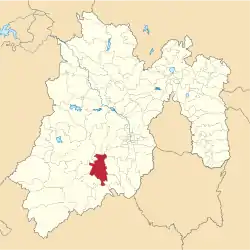
Municipio Coatepec Harinas
| Coatepec Harinas | ||
|---|---|---|
 | ||
| Symbole | ||
| ||
| Basisdaten | ||
| Staat | Mexiko | |
| Bundesstaat | México | |
| Sitz | Coatepec Harinas | |
| Fläche | 283 km² | |
| Einwohner | 36.174 (2010) | |
| Dichte | 127,8 Einwohner pro km² | |
| Gründung | 1825 | |
| Webauftritt | coatepech.gob.mx | |
| INEGI-Nr. | 15021 | |
| Politik | ||
| Presidente municipal | Gilberto Mendez Díaz | |
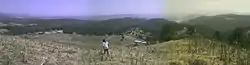 Panoramablick vom Berg El Picacho | ||

Coatepec Harinas ist ein Municipio im mexikanischen Bundesstaat México. Das Municipio hatte beim Zensus 2010 36.174 Einwohner, seine Fläche beläuft sich auf 283 km². Verwaltungssitz und größter Ort des Municipios mit knapp 7.000 Einwohnern ist das gleichnamige Coatapec Harinas; weitere Orte mit mehr als tausend Einwohnern sind Acuitlapilco, Primera de Analco, Llano Grande und Chiltepec de Hidalgo.
Geographie
Coatepec Harinas liegt im Südwesten des Bundesstaats México, etwa 50 km südwestlich von Toluca de Lerdo.
Das Municipio Coatepec Harinas grenzt an die Municipios Villa Guerrero, Toluca, Temascaltepec, Zinacantepec, Texcaltitlán, Ixtapan de la Sal und Almoloya de Alquisiras.
Weblinks
- Enciclopedia de los Municipios y Delegaciones de México: Municipio Coatepec Harinas (spanisch)
- INEGI: Datos Geográficos: Municipio Coatepec Harinas (spanisch; PDF)

Acambay | Acolman | Aculco | Almoloya de Alquisiras | Almoloya de Juárez | Almoloya del Río | Amanalco | Amatepec | Amecameca | Apaxco | Atenco | Atizapán | Atizapán de Zaragoza | Atlacomulco | Atlautla | Axapusco | Ayapango | Calimaya | Capulhuac | Chalco | Chapa de Mota | Chapultepec | Chiautla | Chicoloapan | Chiconcuac | Chimalhuacán | Coacalco de Berriozábal | Coatepec Harinas | Cocotitlán | Coyotepec | Cuautitlán | Cuautitlán Izcalli | Donato Guerra | Ecatepec de Morelos | Ecatzingo | El Oro | Huehuetoca | Hueypoxtla | Huixquilucan | Isidro Fabela | Ixtapaluca | Ixtapan de la Sal | Ixtapan del Oro | Ixtlahuaca | Jaltenco | Jilotepec | Jilotzingo | Jiquipilco | Jocotitlán | Joquicingo | Juchitepec | La Paz | Lerma | Luvianos | Malinalco | Melchor Ocampo | Metepec | Mexicaltzingo | Morelos | Naucalpan de Juárez | Nextlalpan | Nezahualcóyotl | Nicolás Romero | Nopaltepec | Ocoyoacac | Ocuilan | Otumba | Otzoloapan | Otzolotepec | Ozumba | Papalotla | Polotitlán | Rayón | San Antonio la Isla | San Felipe del Progreso | San José del Rincón | San Martín de las Pirámides | San Mateo Atenco | San Simón de Guerrero | Santo Tomás | Soyaniquilpan de Juárez | Sultepec | Tecámac | Tejupilco | Temamatla | Temascalapa | Temascalcingo | Temascaltepec | Temoaya | Tenancingo | Tenango del Aire | Tenango del Valle | Teoloyucan | Teotihuacán | Tepetlaoxtoc | Tepetlixpa | Tepotzotlán | Tequixquiac | Texcaltitlán | Texcalyacac | Texcoco | Tezoyuca | Tianguistenco | Timilpan | Tlalmanalco | Tlalnepantla de Baz | Tlatlaya | Toluca | Tonanitla | Tonatico | Tultepec | Tultitlán | Valle de Bravo | Valle de Chalco Solidaridad | Villa de Allende | Villa del Carbón | Villa Guerrero | Villa Victoria | Xalatlaco | Xonacatlán | Zacazonapan | Zacualpan | Zinacantepec | Zumpahuacán | Zumpango