La Bazouge-du-Désert
La Bazouge-du-Désert, auf Bretonisch Bazaleg-an-Dezerzh, auf Gallo La Bazòj-deü-Dezèrt, ist eine Gemeinde im französischen Département Ille-et-Vilaine in der Bretagne. Sie gehört zum Kanton Fougères-2 (bis 2015 Kanton Louvigné-du-Désert) im Arrondissement Fougères-Vitré. Sie grenzt im Norden an Louvigné-du-Désert, im Nordosten an Landivy, im Osten an Pontmain, im Südosten an Saint-Ellier-du-Maine und im Süden und im Westen an Landéan.
| La Bazouge-du-Désert | ||
|---|---|---|
.svg.png.webp)
|
| |
| Staat | Frankreich | |
| Region | Bretagne | |
| Département (Nr.) | Ille-et-Vilaine (35) | |
| Arrondissement | Fougères-Vitré | |
| Kanton | Fougères-2 | |
| Gemeindeverband | Fougères Agglomération | |
| Koordinaten | 48° 27′ N, 1° 6′ W | |
| Höhe | 113–193 m | |
| Fläche | 25,11 km² | |
| Einwohner | 1.069 (1. Januar 2019) | |
| Bevölkerungsdichte | 43 Einw./km² | |
| Postleitzahl | 35420 | |
| INSEE-Code | 35018 | |
_Mairie.jpg.webp) Mairie La Bazouge-du-Désert | ||

Bevölkerungsentwicklung
| Jahr | 1962 | 1968 | 1975 | 1982 | 1990 | 1999 | 2008 | 2013 |
|---|---|---|---|---|---|---|---|---|
| Einwohner | 1.399 | 1.340 | 1.280 | 1.158 | 1.074 | 1.012 | 1.053 | 1.110 |
Sehenswürdigkeiten
- Kirche Saint-Martin
- Ehemaliger Wachposten
- Flurkreuz
_%C3%89glise_05.JPG.webp) Kirche Saint-Martin
Kirche Saint-Martin_Malagra_05.JPG.webp) Haus aus dem Jahr 1716, das während der Schlacht von La Bazouge-du-Désert als Wachposten diente
Haus aus dem Jahr 1716, das während der Schlacht von La Bazouge-du-Désert als Wachposten diente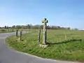 Flurkreuz
Literatur
- Le Patrimoine des Communes d’Ille-et-Vilaine. Flohic Editions, Band 1, Paris 2000, ISBN 2-84234-072-8, S. 823–824.
This article is issued from Wikipedia. The text is licensed under Creative Commons - Attribution - Sharealike. The authors of the article are listed here. Additional terms may apply for the media files, click on images to show image meta data.