Kanton Valognes
Der Kanton Valognes ist ein französischer Wahlkreis im Arrondissement Cherbourg, im Département Manche und in der Region Normandie. Vertreter im Generalrat des Départements ist seit 2004 Yves Néel (PS).
| Kanton Valognes | |
|---|---|
| Region | Normandie |
| Département | Manche |
| Arrondissement | Cherbourg |
| Hauptort | Valognes |
| Einwohner | 20.597 (1. Jan. 2019) |
| Bevölkerungsdichte | 76 Einw./km² |
| Fläche | 271,45 km² |
| Gemeinden | 31 |
| INSEE-Code | 5025 |
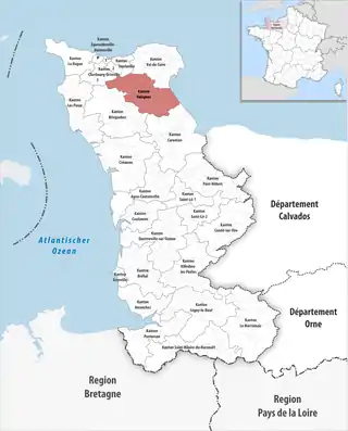 Lage des Kantons Valognes im Département Manche | |
Der Kanton Valognes hatte zum 1. Januar 2019 insgesamt 20.597 Einwohner.
Gemeinden
Der Kanton besteht aus 31 Gemeinden mit insgesamt 20.597 Einwohnern (Stand: 1. Januar 2019) auf einer Gesamtfläche von 271,45 km²:
| Gemeinde | Einwohner 1. Januar 2019 |
Fläche km² |
Dichte Einw./km² |
Code INSEE |
Postleitzahl |
|---|---|---|---|---|---|
| Azeville | 80 | 3,05 | 26 | 50026 | 50310 |
| Brix | 2.155 | 32,30 | 67 | 50087 | 50700 |
| Écausseville | 103 | 5,23 | 20 | 50169 | 50310 |
| Émondeville | 350 | 5,35 | 65 | 50172 | 50310 |
| Éroudeville | 196 | 4,85 | 40 | 50175 | 50310 |
| Flottemanville | 218 | 4,77 | 46 | 50186 | 50700 |
| Fontenay-sur-Mer | 171 | 8,21 | 21 | 50190 | 50310 |
| Fresville | 370 | 14,04 | 26 | 50194 | 50310 |
| Hémevez | 181 | 4,32 | 42 | 50241 | 50700 |
| Huberville | 365 | 5,64 | 65 | 50251 | 50700 |
| Joganville | 112 | 2,86 | 39 | 50258 | 50310 |
| Le Ham | 310 | 3,87 | 80 | 50227 | 50310 |
| Lestre | 249 | 7,74 | 32 | 50268 | 50310 |
| Lieusaint | 399 | 5,32 | 75 | 50270 | 50700 |
| Montaigu-la-Brisette | 501 | 14,72 | 34 | 50335 | 50700 |
| Montebourg | 2.106 | 5,84 | 361 | 50341 | 50310 |
| Ozeville | 154 | 4,76 | 32 | 50390 | 50310 |
| Quinéville | 267 | 4,67 | 57 | 50421 | 50310 |
| Saint-Cyr | 198 | 5,79 | 34 | 50461 | 50310 |
| Saint-Floxel | 494 | 8,52 | 58 | 50467 | 50310 |
| Saint-Germain-de-Tournebut | 426 | 13,91 | 31 | 50478 | 50700 |
| Saint-Joseph | 798 | 9,87 | 81 | 50498 | 50700 |
| Saint-Marcouf | 344 | 13,62 | 25 | 50507 | 50310 |
| Saint-Martin-d’Audouville | 128 | 3,64 | 35 | 50511 | 50310 |
| Saussemesnil | 880 | 21,71 | 41 | 50567 | 50700 |
| Sortosville | 79 | 2,50 | 32 | 50578 | 50310 |
| Tamerville | 678 | 18,19 | 37 | 50588 | 50700 |
| Urville | 209 | 5,17 | 40 | 50610 | 50700 |
| Valognes | 6.822 | 15,78 | 432 | 50615 | 50700 |
| Vaudreville | 72 | 3,01 | 24 | 50621 | 50310 |
| Yvetot-Bocage | 1.182 | 12,20 | 97 | 50648 | 50700 |
| Kanton Valognes | 20.597 | 271,45 | 76 | 5025 | – |
Bis zur Neuordnung bestand der Kanton Valognes aus den 9 Gemeinden Brix, Huberville, Lieusaint, Montaigu-la-Brisette, Saint-Joseph, Saussemesnil, Tamerville, Valognes und Yvetot-Bocage. Sein Zuschnitt entsprach einer Fläche von 135,37 km2.
This article is issued from Wikipedia. The text is licensed under Creative Commons - Attribution - Sharealike. The authors of the article are listed here. Additional terms may apply for the media files, click on images to show image meta data.