Kanton Condé-sur-Vire
Der Kanton Condé-sur-Vire ist ein französischer Wahlkreis im Arrondissement Saint-Lô, im Département Manche und in der Region Normandie; sein Hauptort ist Condé-sur-Vire.
| Kanton Condé-sur-Vire | |
|---|---|
| Region | Normandie |
| Département | Manche |
| Arrondissement | Saint-Lô |
| Hauptort | Condé-sur-Vire |
| Einwohner | 19.980 (1. Jan. 2019) |
| Bevölkerungsdichte | 66 Einw./km² |
| Fläche | 304,07 km² |
| Gemeinden | 17 |
| INSEE-Code | 5009 |
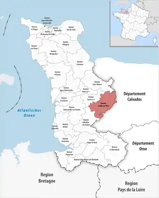 Lage des Kantons Condé-sur-Vire im Département Manche | |
Gemeinden
Der Kanton besteht aus 17 Gemeinden mit insgesamt 19.980 Einwohnern (Stand: 1. Januar 2019) auf einer Gesamtfläche von 304,07 km²:
| Gemeinde | Einwohner 1. Januar 2019 |
Fläche km² |
Dichte Einw./km² |
Code INSEE |
Postleitzahl |
|---|---|---|---|---|---|
| Beaucoudray | 126 | 4,72 | 27 | 50039 | 50420 |
| Beuvrigny | 138 | 6,85 | 20 | 50050 | 50420 |
| Biéville | 191 | 5,58 | 34 | 50054 | 50160 |
| Condé-sur-Vire | 4.044 | 36,82 | 110 | 50139 | 50420, 50890 |
| Domjean | 1.006 | 16,60 | 61 | 50164 | 50420 |
| Fourneaux | 130 | 3,39 | 38 | 50192 | 50420 |
| Gouvets | 275 | 11,20 | 25 | 50214 | 50420 |
| Lamberville | 169 | 7,17 | 24 | 50261 | 50160 |
| Le Perron | 201 | 4,72 | 43 | 50398 | 50160 |
| Montrabot | 92 | 3,88 | 24 | 50351 | 50810 |
| Moyon Villages | 1.451 | 33,13 | 44 | 50363 | 50860 |
| Saint-Amand-Villages | 2.500 | 38,45 | 65 | 50444 | 50160 |
| Saint-Jean-d’Elle | 2.498 | 33,86 | 74 | 50492 | 50810 |
| Saint-Louet-sur-Vire | 206 | 7,50 | 27 | 50504 | 50420 |
| Saint-Vigor-des-Monts | 279 | 16,00 | 17 | 50563 | 50420 |
| Tessy-Bocage | 2.277 | 34,73 | 66 | 50592 | 50420 |
| Torigny-les-Villes | 4.397 | 39,47 | 111 | 50601 | 50160 |
| Kanton Condé-sur-Vire | 19.980 | 304,07 | 66 | 5009 | – |
Veränderungen im Gemeindebestand seit der landesweiten Neuordnung der Kantone
2018:
- Fusion Pont-Farcy (Kanton Vire, Département Calvados) und Tessy Bocage → Tessy Bocage
2017:
- Fusion Condé-sur-Vire und Troisgots → Condé-sur-Vire
- Fusion Placy-Montaigu und Saint-Amand → Saint-Amand-Villages
2016:
- Fusion Condé-sur-Vire und Le Mesnil-Raoult → Condé-sur-Vire
- Fusion Chevry, Le Mesnil-Opac und Moyon → Moyon Villages
- Fusion Notre-Dame-d’Elle (Kanton Pont-Hébert), Précorbin, Rouxeville, Saint-Jean-des-Baisants und Vidouville → Saint-Jean-d’Elle
- Fusion Fervaches und Tessy-sur-Vire → Tessy Bocage
- Fusion Brectouville, Giéville, Guilberville und Torigni-sur-Vire → Torigny-les-Villes
This article is issued from Wikipedia. The text is licensed under Creative Commons - Attribution - Sharealike. The authors of the article are listed here. Additional terms may apply for the media files, click on images to show image meta data.