Kanton Saint-Hilaire-du-Harcouët
Der Kanton Saint-Hilaire-du-Harcouët ist ein französischer Wahlkreis im Arrondissement Avranches, im Département Manche und in der Region Normandie; sein Hauptort ist Saint-Hilaire-du-Harcouët.
| Kanton Saint-Hilaire-du-Harcouët | |
|---|---|
| Region | Normandie |
| Département | Manche |
| Arrondissement | Avranches |
| Hauptort | Saint-Hilaire-du-Harcouët |
| Einwohner | 18.992 (1. Jan. 2019) |
| Bevölkerungsdichte | 56 Einw./km² |
| Fläche | 339,37 km² |
| Gemeinden | 15 |
| INSEE-Code | 5021 |
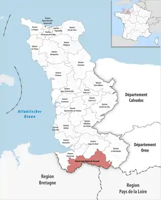 Lage des Kantons Saint-Hilaire-du-Harcouët im Département Manche | |
Der Kanton Saint-Hilaire-du-Harcouët hatte zum 1. Januar 2019 insgesamt 18.992 Einwohner.
Gemeinden
Der Kanton besteht aus 15 Gemeinden mit insgesamt 18.992 Einwohnern (Stand: 1. Januar 2019) auf einer Gesamtfläche von 339,37 km²:
| Gemeinde | Einwohner 1. Januar 2019 |
Fläche km² |
Dichte Einw./km² |
Code INSEE |
Postleitzahl |
|---|---|---|---|---|---|
| Buais-Les-Monts | 611 | 24,85 | 25 | 50090 | 50640 |
| Grandparigny | 2.643 | 35,12 | 75 | 50391 | 50600 |
| Hamelin | 87 | 2,51 | 35 | 50229 | 50730 |
| Lapenty | 364 | 14,91 | 24 | 50263 | 50600 |
| Le Mesnillard | 248 | 9,92 | 25 | 50315 | 50600 |
| Les Loges-Marchis | 1.012 | 20,33 | 50 | 50274 | 50600 |
| Montjoie-Saint-Martin | 234 | 7,48 | 31 | 50347 | 50240 |
| Moulines | 285 | 7,55 | 38 | 50362 | 50600 |
| Saint-Aubin-de-Terregatte | 661 | 21,38 | 31 | 50448 | 50240 |
| Saint-Brice-de-Landelles | 664 | 15,41 | 43 | 50452 | 50730 |
| Saint-Hilaire-du-Harcouët | 5.850 | 47,29 | 124 | 50484 | 50600, 50730 |
| Saint-James | 4.907 | 87,47 | 56 | 50487 | 50240 |
| Saint-Laurent-de-Terregatte | 654 | 16,69 | 39 | 50500 | 50240 |
| Saint-Senier-de-Beuvron | 346 | 11,15 | 31 | 50553 | 50240 |
| Savigny-le-Vieux | 426 | 17,31 | 25 | 50570 | 50640 |
| Kanton Saint-Hilaire-du-Harcouët | 18.992 | 339,37 | 56 | 5021 | – |
Bis zur Neuordnung bestand der Kanton Saint-Hilaire-du-Harcouët aus den 12 Gemeinden Chèvreville, Lapenty, Les Loges-Marchis, Martigny, Le Mesnillard, Milly, Moulines, Parigny, Saint-Brice-de-Landelles, Saint-Hilaire-du-Harcouët, Saint-Martin-de-Landelles und Virey. Sein Zuschnitt entsprach einer Fläche von 148 km2.
Veränderungen im Gemeindebestand seit der landesweiten Neuordnung der Kantone
2017:
- Fusion Argouges, Carnet, La Croix-Avranchin, Montanel, Saint-James, Vergoncey und Villiers-le-Pré → Saint-James
2016:
- Fusion Buais und Saint-Symphorien-des-Monts → Buais-Les-Monts
- Fusion Chèvreville, Martigny, Milly und Parigny → Grandparigny
- Fusion Saint-Hilaire-du-Harcouët, Saint-Martin-de-Landelles und Virey → Saint-Hilaire-du-Harcouët
This article is issued from Wikipedia. The text is licensed under Creative Commons - Attribution - Sharealike. The authors of the article are listed here. Additional terms may apply for the media files, click on images to show image meta data.