Kanton Bréhal
Der Kanton Bréhal ist ein französischer Wahlkreis im Arrondissement Avranches, im Département Manche und in der Region Normandie; sein Hauptort ist Bréhal.
| Kanton Bréhal | |
|---|---|
| Region | Normandie |
| Département | Manche |
| Arrondissement | Avranches |
| Hauptort | Bréhal |
| Einwohner | 20.495 (1. Jan. 2019) |
| Bevölkerungsdichte | 84 Einw./km² |
| Fläche | 244,13 km² |
| Gemeinden | 27 |
| INSEE-Code | 5003 |
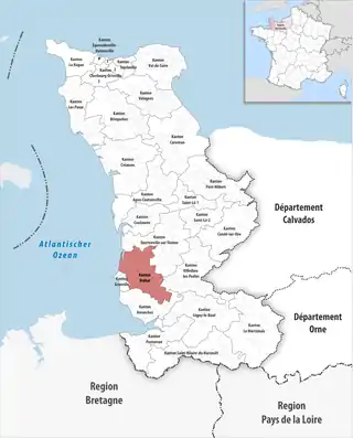 Lage des Kantons Bréhal im Département Manche | |
Gemeinden
Der Kanton besteht aus 27 Gemeinden mit insgesamt 20.495 Einwohnern (Stand: 1. Januar 2019) auf einer Gesamtfläche von 244,13 km²:
| Gemeinde | Einwohner 1. Januar 2019 |
Fläche km² |
Dichte Einw./km² |
Code INSEE |
Postleitzahl |
|---|---|---|---|---|---|
| Anctoville-sur-Boscq | 443 | 2,15 | 206 | 50008 | 50400 |
| Beauchamps | 426 | 4,11 | 104 | 50038 | 50320 |
| Bréhal | 3.455 | 13,15 | 263 | 50076 | 50290 |
| Bréville-sur-Mer | 771 | 6,71 | 115 | 50081 | 50290 |
| Bricqueville-sur-Mer | 1.223 | 12,90 | 95 | 50085 | 50290 |
| Cérences | 1.779 | 26,22 | 68 | 50109 | 50510 |
| Chanteloup | 359 | 4,27 | 84 | 50120 | 50510 |
| Coudeville-sur-Mer | 859 | 8,84 | 97 | 50143 | 50290 |
| Équilly | 196 | 5,82 | 34 | 50174 | 50320 |
| Folligny | 1.084 | 11,90 | 91 | 50188 | 50320 |
| Hocquigny | 188 | 3,06 | 61 | 50247 | 50320 |
| Hudimesnil | 908 | 19,06 | 48 | 50252 | 50510 |
| La Haye-Pesnel | 1.258 | 6,39 | 197 | 50237 | 50320 |
| La Lucerne-d’Outremer | 772 | 14,59 | 53 | 50281 | 50320 |
| La Meurdraquière | 186 | 7,68 | 24 | 50327 | 50510 |
| La Mouche | 241 | 4,56 | 53 | 50361 | 50320 |
| Le Grippon | 383 | 9,98 | 38 | 50115 | 50320 |
| Le Loreur | 283 | 3,24 | 87 | 50278 | 50510 |
| Le Luot | 298 | 8,58 | 35 | 50282 | 50870 |
| Le Mesnil-Aubert | 195 | 5,95 | 33 | 50304 | 50510 |
| Longueville | 590 | 4,23 | 139 | 50277 | 50290 |
| Muneville-sur-Mer | 489 | 7,45 | 66 | 50365 | 50290 |
| Saint-Aubin-des-Préaux | 458 | 8,46 | 54 | 50447 | 50380 |
| Saint-Jean-des-Champs | 1.443 | 19,35 | 75 | 50493 | 50320 |
| Saint-Planchers | 1.399 | 12,19 | 115 | 50541 | 50400 |
| Saint-Sauveur-la-Pommeraye | 402 | 5,38 | 75 | 50549 | 50510 |
| Subligny | 407 | 7,91 | 51 | 50584 | 50870 |
| Kanton Bréhal | 20.495 | 244,13 | 84 | 5003 | – |
Bis zur Neuordnung bestand der Kanton Bréhal aus den 14 Gemeinden Anctoville-sur-Boscq, Bréhal, Bréville-sur-Mer, Bricqueville-sur-Mer, Cérences, Chanteloup, Coudeville-sur-Mer, Hudimesnil, Longueville, Le Loreur, Le Mesnil-Aubert, La Meurdraquière, Muneville-sur-Mer und Saint-Sauveur-la-Pommeraye. Sein Zuschnitt entsprach einer Fläche von 125,74 km2.
Veränderungen im Gemeindebestand seit 2016
2016:
- Fusion Champcervon und Les Chambres → Le Grippon
- Fusion Braffais (Kanton Isigny-le-Buat), Plomb (Kanton Avranches) und Sainte-Pience → Le Parc
- Fusion Angey (Kanton Avranches), Champcey (Kanton Avranches), La Rochelle-Normande, Montviron (Kanton Avranches) und Sartilly (Kanton Avranches) → Sartilly-Baie-Bocage
This article is issued from Wikipedia. The text is licensed under Creative Commons - Attribution - Sharealike. The authors of the article are listed here. Additional terms may apply for the media files, click on images to show image meta data.