Estancarbon
Estancarbon (okzitanisch Estanhcarbon) ist eine französische Gemeinde mit 608 Einwohnern (Stand: 1. Januar 2019) im Département Haute-Garonne in der Region Okzitanien; sie ist Teil des Arrondissements Saint-Gaudens und des Kantons Saint-Gaudens. Die Einwohner werden Estancarbonais genannt.
| Estancarbon Estanhcarbon | ||
|---|---|---|
| ||
| Staat | Frankreich | |
| Region | Okzitanien | |
| Département (Nr.) | Haute-Garonne (31) | |
| Arrondissement | Saint-Gaudens | |
| Kanton | Saint-Gaudens | |
| Gemeindeverband | Cœur et Coteaux du Comminges | |
| Koordinaten | 43° 6′ N, 0° 47′ O | |
| Höhe | 325–392 m | |
| Fläche | 6,35 km² | |
| Einwohner | 608 (1. Januar 2019) | |
| Bevölkerungsdichte | 96 Einw./km² | |
| Postleitzahl | 31800 | |
| INSEE-Code | 31175 | |
| Website | http://www.estancarbon.com/ | |
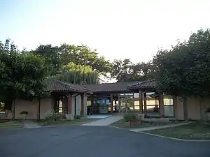
 Mairie Estancarbon | ||
Geografie
Estancarbon liegt in der historischen Provinz Comminges am Fuß der Pyrenäen und am Ufer der Garonne, etwa 80 Kilometer südwestlich von Toulouse. Umgeben wird Estancarbon von den Nachbargemeinden Landorthe im Norden, Savarthès im Norden und Nordosten, Labarthe-Inard im Osten, Pointis-Inard im Süden und Südosten, Miramont-de-Comminges im Süden und Südwesten sowie Saint-Gaudens im Westen.
Bevölkerungsentwicklung
| Jahr | 1962 | 1968 | 1975 | 1982 | 1990 | 1999 | 2006 | 2017 |
|---|---|---|---|---|---|---|---|---|
| Einwohner | 314 | 313 | 398 | 465 | 509 | 530 | 542 | 606 |
| Quellen: Cassini und INSEE | ||||||||
Sehenswürdigkeiten
- Kirche Notre-Dame
- Burg Mariande aus dem 14./15. Jahrhundert
 Kirche Notre-Dame
 Burg Mariande
 Marienstatue
 Gefallenendenkmal
 Grundschule
Literatur
- Le Patrimoine des Communes de la Haute-Garonne. Flohic Editions, Band 2, Paris 2000, ISBN 2-84234-081-7, S. 1334–1335.
This article is issued from Wikipedia. The text is licensed under Creative Commons - Attribution - Sharealike. The authors of the article are listed here. Additional terms may apply for the media files, click on images to show image meta data.
