Montgaillard-de-Salies
Montgaillard-de-Salies ist eine französische Gemeinde mit 104 Einwohnern (Stand: 1. Januar 2019) im Département Haute-Garonne in der Region Okzitanien. Sie gehört zum Kanton Bagnères-de-Luchon und zum Arrondissement Saint-Gaudens.
| Montgaillard-de-Salies | ||
|---|---|---|
| ||
| Staat | Frankreich | |
| Region | Okzitanien | |
| Département (Nr.) | Haute-Garonne (31) | |
| Arrondissement | Saint-Gaudens | |
| Kanton | Bagnères-de-Luchon | |
| Gemeindeverband | Communauté de communes Cagire Garonne Salat | |
| Koordinaten | 43° 4′ N, 0° 56′ O | |
| Höhe | 307–424 m | |
| Fläche | 6,12 km² | |
| Einwohner | 104 (1. Januar 2019) | |
| Bevölkerungsdichte | 17 Einw./km² | |
| Postleitzahl | 31260 | |
| INSEE-Code | 31376 | |
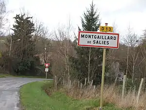 Dorfeingang von Montgaillard-de-Salies | ||

Lage
Die Gemeinde wird vom Fluss Arbas durchquert. Nachbargemeinden sind Figarol im Nordwesten, Mane im Norden, His im Osten, Saleich im Südosten, Castelbiague im Süden und Montastruc-de-Salies im Westen.
Bevölkerungsentwicklung
| Jahr | 1962 | 1968 | 1975 | 1982 | 1990 | 1999 | 2008 | 2015 | 2016 |
|---|---|---|---|---|---|---|---|---|---|
| Einwohner | 183 | 162 | 135 | 134 | 118 | 105 | 101 | 101 | 102 |
This article is issued from Wikipedia. The text is licensed under Creative Commons - Attribution - Sharealike. The authors of the article are listed here. Additional terms may apply for the media files, click on images to show image meta data.