Colméry
Colméry ist eine französische Gemeinde mit 276 Einwohnern (Stand 1. Januar 2019) im Département Nièvre in der Region Bourgogne-Franche-Comté (vor 2016 Bourgogne). Sie gehört zum Arrondissement Cosne-Cours-sur-Loire und zum Kanton Pouilly-sur-Loire (bis 2015 Donzy). Die Einwohner werden Colmérycois genannt.
| Colméry | ||
|---|---|---|
| ||
| Staat | Frankreich | |
| Region | Bourgogne-Franche-Comté | |
| Département (Nr.) | Nièvre (58) | |
| Arrondissement | Cosne-Cours-sur-Loire | |
| Kanton | Pouilly-sur-Loire | |
| Gemeindeverband | Communauté de communes Loire, Vignobles et Nohain | |
| Koordinaten | 47° 21′ N, 3° 15′ O | |
| Höhe | 200–360 m | |
| Fläche | 24,21 km² | |
| Einwohner | 276 (1. Januar 2019) | |
| Bevölkerungsdichte | 11 Einw./km² | |
| Postleitzahl | 58220 | |
| INSEE-Code | 58081 | |
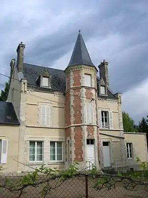 Rathaus (Mairie) von Colméry | ||

Nachbargemeinden
Colméry liegt etwa 35 Kilometer nordnordöstlich von Nevers. Nachbargemeinden von Colméry sind Couloutre im Norden und Nordwesten, Menou im Norden und Nordosten, Oudan im Osten, Saint-Malo-en-Donziois im Süden und Südosten, Cessy-les-Bois im Süden und Westen sowie Donzy im Westen und Nordwesten.
Bevölkerungsentwicklung
| Jahr | 1962 | 1968 | 1975 | 1982 | 1990 | 1999 | 2006 | 2011 | 2016 |
|---|---|---|---|---|---|---|---|---|---|
| Einwohner | 503 | 424 | 319 | 274 | 254 | 247 | 300 | 331 | 344 |
| Quellen: Cassini und INSEE | |||||||||
Sehenswürdigkeiten
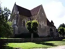
- Kirche Saint-Aignan aus dem Jahre 1536, Monument historique seit 1971
Literatur
- Le Patrimoine des Communes de la Nièvre. Band 1, Flohic Editions, Charenton-le-Pont 1999, ISBN 2-84234-054-X, S. 389–390.
This article is issued from Wikipedia. The text is licensed under Creative Commons - Attribution - Sharealike. The authors of the article are listed here. Additional terms may apply for the media files, click on images to show image meta data.