Oulon
Oulon ist eine französische Gemeinde mit 63 Einwohnern (Stand 1. Januar 2019) im Département Nièvre in der Region Bourgogne-Franche-Comté (vor 2016 Bourgogne). Sie gehört zum Arrondissement Cosne-Cours-sur-Loire und zum Kanton La Charité-sur-Loire (bis 2015 Prémery).
| Oulon | ||
|---|---|---|
| ||
| Staat | Frankreich | |
| Region | Bourgogne-Franche-Comté | |
| Département (Nr.) | Nièvre (58) | |
| Arrondissement | Cosne-Cours-sur-Loire | |
| Kanton | La Charité-sur-Loire | |
| Gemeindeverband | Communauté de communes Loire, Nièvre et Bertranges | |
| Koordinaten | 47° 12′ N, 3° 24′ O | |
| Höhe | 246–364 m | |
| Fläche | 11,08 km² | |
| Einwohner | 63 (1. Januar 2019) | |
| Bevölkerungsdichte | 6 Einw./km² | |
| Postleitzahl | 58700 | |
| INSEE-Code | 58203 | |
| Website | https://oulon.fr/ | |
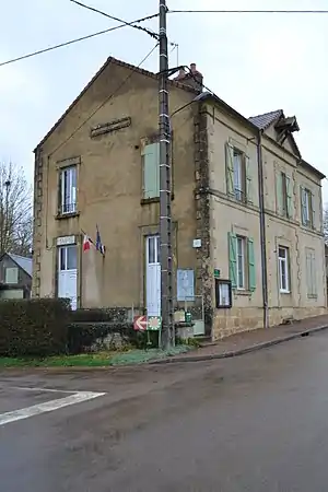 Rathaus (Mairie) von Oulon | ||

Nachbargemeinden
Oulon liegt etwa 27 Kilometer nordöstlich von Nevers. Nachbargemeinden von Oulon sind Montenoison im Norden und Osten, Moussy im Osten und Südosten, Saint-Franchy im Südosten, Lurcy-le-Bourg im Süden, Prémery im Südwesten sowie Giry im Westen und Nordwesten.
Bevölkerungsentwicklung
| Jahr | 1962 | 1968 | 1975 | 1982 | 1990 | 1999 | 2006 | 2011 | 2016 |
|---|---|---|---|---|---|---|---|---|---|
| Einwohner | 156 | 130 | 99 | 77 | 84 | 83 | 85 | 73 | 66 |
| Quellen: Cassini und INSEE | |||||||||
Sehenswürdigkeiten
- Kirche Saint-Andoche aus dem 16. Jahrhundert
- Schloss Giry aus dem 16. Jahrhundert
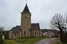
Kirche Saint-Andoche
Literatur
- Le Patrimoine des Communes de la Nièvre. Band 2, Flohic Editions, Charenton-le-Pont 1999, ISBN 2-84234-054-X, S. 857–858.
This article is issued from Wikipedia. The text is licensed under Creative Commons - Attribution - Sharealike. The authors of the article are listed here. Additional terms may apply for the media files, click on images to show image meta data.