Chalou-Moulineux
Chalou-Moulineux ist eine französische Gemeinde mit 404 Einwohnern (Stand: 1. Januar 2019) im Département Essonne in der Region Île-de-France; sie gehört zum Arrondissement Étampes und zum Kanton Étampes (bis 2015: Kanton Méréville). Die Einwohner heißen Calo-Moulinotins.
| Chalou-Moulineux | ||
|---|---|---|
.svg.png.webp)
|
| |
| Staat | Frankreich | |
| Region | Île-de-France | |
| Département (Nr.) | Essonne (91) | |
| Arrondissement | Étampes | |
| Kanton | Étampes | |
| Gemeindeverband | Étampois Sud Essonne | |
| Koordinaten | 48° 23′ N, 2° 1′ O | |
| Höhe | 96–148 m | |
| Fläche | 10,75 km² | |
| Einwohner | 404 (1. Januar 2019) | |
| Bevölkerungsdichte | 38 Einw./km² | |
| Postleitzahl | 91740 | |
| INSEE-Code | 91131 | |
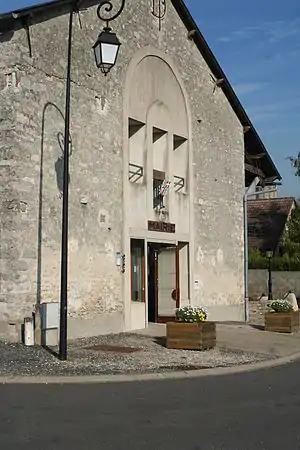 Rathaus (Mairie) von Chalou-Moulineux | ||

Geographie
Chalou-Moulineux liegt etwa 57 Kilometer südsüdwestlich von Paris. Umgeben wird Chalou-Moulineux von den Nachbargemeinden Chalo-Saint-Mars im Norden und Nordosten, Guillerval im Osten und Südosten, Monnerville im Süden, Pussay im Süden und Südwesten sowie Congerville-Thionville im Westen.
Bevölkerungsentwicklung
| Jahr | 1962 | 1968 | 1975 | 1982 | 1990 | 1999 | 2006 | 2013 |
| Einwohner | 232 | 226 | 232 | 303 | 389 | 370 | 396 | 421 |
| Quelle: Cassini und INSEE | ||||||||
Sehenswürdigkeiten
- Kirche Saint-Aignan aus dem 11. Jahrhundert, Monument historique seit 1926
- frühere Kirche Saint-Thomas-Becket, 1228 erbaut, bis 1793 als Kirchbau genutzt, Monument historique seit 1931
- Waschhaus aus dem 19. Jahrhundert
.jpg.webp) Kirche Saint-Aignan
Kirche Saint-Aignan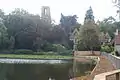 Kirche Saint-Thomas-Beckett
Literatur
- Le Patrimoine des Communes de l’Essonne. Flohic Éditions, Paris 2001, Band 2, ISBN 2-84234-126-0, S. 644–646.
Weblinks
Commons: Chalou-Moulineux – Sammlung von Bildern, Videos und Audiodateien
This article is issued from Wikipedia. The text is licensed under Creative Commons - Attribution - Sharealike. The authors of the article are listed here. Additional terms may apply for the media files, click on images to show image meta data.