Villers-sous-Foucarmont
Villers-sous-Foucarmont ist eine französische Gemeinde mit 188 Einwohnern (Stand: 1. Januar 2019) im Département Seine-Maritime in der Region Normandie. Sie gehört zum Arrondissement Dieppe und zum Kanton Eu. Die Arbeitslosenquote in Villers-sous-Fourcamont liegt bei 11 % (Stand 1. Januar 2016).
| Villers-sous-Foucarmont | ||
|---|---|---|
| ||
| Staat | Frankreich | |
| Region | Normandie | |
| Département (Nr.) | Seine-Maritime (76) | |
| Arrondissement | Dieppe | |
| Kanton | Eu | |
| Gemeindeverband | Aumale Blangy-sur-Bresle | |
| Koordinaten | 49° 50′ N, 1° 34′ O | |
| Höhe | 112–223 m | |
| Fläche | 7,07 km² | |
| Einwohner | 188 (1. Januar 2019) | |
| Bevölkerungsdichte | 27 Einw./km² | |
| Postleitzahl | 76340 | |
| INSEE-Code | 76744 | |
 Rathaus (Mairie) von Villers-sous-Foucarmont | ||

Geographie
Villers-sous-Foucarmont liegt etwa 50 Kilometer ostsüdöstlich von Dieppe. Umgeben wird Villers-sous-Foucarmont von den Nachbargemeinden Foucarmont im Norden, Saint-Léger-aux-Bois im Osten und Nordosten, Rétonval im Osten und Südosten, Aubermesnil-aux-Érables im Süden, Saint-Germain-sur-Eaulne und Vatierville im Süden und Südwesten sowie Callengeville im Westen.
Bevölkerungsentwicklung
| Jahr | 1962 | 1968 | 1975 | 1982 | 1990 | 1999 | 2006 | 2007 | 2008 | 2009 | 2010 | 2011 | 2012 | 2013 | 2014 | 2015 | 2016 | 2017 |
| Einwohner | 179 | 164 | 170 | 160 | 172 | 205 | 203 | 201 | 200 | 198 | 193 | 196 | 197 | 197 | 197 | 197 | 195 | 193 |
Sehenswürdigkeiten
- Kirche
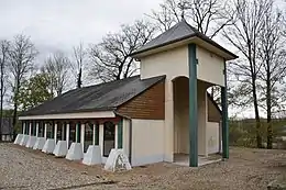
Kirche
This article is issued from Wikipedia. The text is licensed under Creative Commons - Attribution - Sharealike. The authors of the article are listed here. Additional terms may apply for the media files, click on images to show image meta data.