Vendœuvres
Vendœuvres ist eine französische Gemeinde mit 1052 Einwohnern (Stand 1. Januar 2019) im Département Indre in der Region Centre-Val de Loire; sie gehört zum Arrondissement Châteauroux und zum Kanton Saint-Gaultier.
| Vendœuvres | ||
|---|---|---|
| ||
| Staat | Frankreich | |
| Region | Centre-Val de Loire | |
| Département (Nr.) | Indre (36) | |
| Arrondissement | Châteauroux | |
| Kanton | Saint-Gaultier | |
| Gemeindeverband | Val de l’Indre-Brenne | |
| Koordinaten | 46° 48′ N, 1° 22′ O | |
| Höhe | 97–139 m | |
| Fläche | 98,80 km² | |
| Einwohner | 1.052 (1. Januar 2019) | |
| Bevölkerungsdichte | 11 Einw./km² | |
| Postleitzahl | 36500 | |
| INSEE-Code | 36232 | |
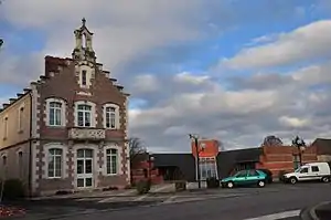
 Rathaus | ||
Geografie
Die Gemeinde liegt im Regionalen Naturpark Brenne. Nachbargemeinden sind Mézières-en-Brenne, Sainte-Gemme, Buzançais, La Chapelle-Orthemale, Neuillay-les-Bois, Méobecq und Migné.
Durch das Gemeindegebiet fließen die Claise und ihr Zufluss Yoson.
Bevölkerungsentwicklung
| Jahr | 1962 | 1968 | 1975 | 1982 | 1990 | 1999 | 2008 | 2012 |
| Einwohner | 1348 | 1183 | 1100 | 1022 | 1042 | 1018 | 1110 | 1143 |
Verkehr
Vendœuvres hatte einen Bahnhof an der Bahnstrecke Le Blanc–Argent-sur-Sauldre, die in diesem Abschnitt 1953 stillgelegt wurde. Im Ort kreuzen sich die Departementsstraßen D 24 (Clion–Ciron) und D 925 (Azay-le-Ferron−Châteauroux),
Sehenswürdigkeiten
- Schloss Lancosme im Forêt de Lancosme (Privatbesitz)
- Kirche Saint-Pierre und Saint-Paul
Weblinks
Commons: Vendœuvres – Sammlung von Bildern, Videos und Audiodateien
This article is issued from Wikipedia. The text is licensed under Creative Commons - Attribution - Sharealike. The authors of the article are listed here. Additional terms may apply for the media files, click on images to show image meta data.
