Velles (Indre)
Velles ist eine französische Gemeinde mit 964 Einwohnern (Stand 1. Januar 2019) im Département Indre in der Region Centre-Val de Loire; sie gehört zum Arrondissement Châteauroux und zum Kanton Argenton-sur-Creuse.
| Velles | ||
|---|---|---|
| ||
| Staat | Frankreich | |
| Region | Centre-Val de Loire | |
| Département (Nr.) | Indre (36) | |
| Arrondissement | Châteauroux | |
| Kanton | Argenton-sur-Creuse | |
| Gemeindeverband | Éguzon-Argenton-Vallée de la Creuse | |
| Koordinaten | 46° 41′ N, 1° 39′ O | |
| Höhe | 117–184 m | |
| Fläche | 64,33 km² | |
| Einwohner | 964 (1. Januar 2019) | |
| Bevölkerungsdichte | 15 Einw./km² | |
| Postleitzahl | 36330 | |
| INSEE-Code | 36231 | |
| Website | www.velles.fr | |
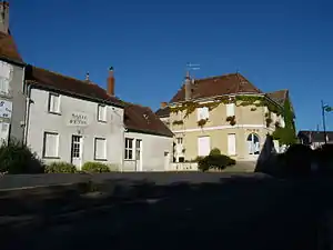 Mairie und Gemeindehalle | ||

Nachbargemeinden von Velles sind Saint-Maur im Norden, Le Poinçonnet im Nordosten, Arthon im Osten, Bouesse im Südosten, Mosnay im Süden, Tendu im Südwesten, und Luant im Westen.
Bevölkerungsentwicklung
| Jahr | 1962 | 1968 | 1975 | 1982 | 1990 | 1999 | 2007 | 2012 |
| Einwohner | 770 | 668 | 716 | 771 | 835 | 827 | 852 | 977 |
Sehenswürdigkeiten
- Schloss Beauregard (15. Jahrhundert, Monument historique)
- Schloss Courcenay (15. Jahrhundert)
- Schloss Le Plessis (18. Jahrhundert)
- Schloss Vauzelles (18. Jahrhundert)
- Der Turm Les Combes d’en Bas (16. Jahrhundert)
- Kirche Saint-Étienne (Glasfenster aus dem 12. Jahrhundert, Monument historique)
- Manoir de Boisé (16. Jahrhundert)
Literatur
- Maxime Rousseau, Le passé d’une localité rurale : Velles en Bas-Berry, Mairie de Velles et Archives départementales de l’Indre, 1996, ISBN 2-86036-000-X.
This article is issued from Wikipedia. The text is licensed under Creative Commons - Attribution - Sharealike. The authors of the article are listed here. Additional terms may apply for the media files, click on images to show image meta data.