Saint-Thibault (Côte-d’Or)
Saint-Thibault ist eine französische Gemeinde mit 161 Einwohnern (Stand 1. Januar 2019) im Département Côte-d’Or in der Region Bourgogne-Franche-Comté. Sie gehört zum Kanton Semur-en-Auxois und zum Arrondissement Montbard.
| Saint-Thibault | ||
|---|---|---|
| ||
| Staat | Frankreich | |
| Region | Bourgogne-Franche-Comté | |
| Département (Nr.) | Côte-d’Or (21) | |
| Arrondissement | Montbard | |
| Kanton | Semur-en-Auxois | |
| Gemeindeverband | Communauté de communes des Terres d’Auxois | |
| Koordinaten | 47° 22′ N, 4° 28′ O | |
| Höhe | 328–450 m | |
| Fläche | 12,38 km² | |
| Einwohner | 161 (1. Januar 2019) | |
| Bevölkerungsdichte | 13 Einw./km² | |
| Postleitzahl | 21350 | |
| INSEE-Code | 21576 | |
 Der Canal de Bourgogne bei Saint-Thibault | ||
Lage
Die Gemeinde liegt in der Naturlandschaft Auxois, rund 14 Kilometer nordwestlich von Pouilly-en-Auxois. Das Gemeindegebiet wird vom Canal de Bourgogne und dem parallel verlaufenden Fluss Armançon durchquert. Die Autobahn A6 verläuft im Südwesten, knapp außerhalb des Gemeindegebietes.
Nachbargemeinden sind im Nordwesten Clamerey, im Norden Velogny, im Nordosten Marcilly-et-Dracy, im Osten Vitteaux, im Südosten Beurizot, im Süden Thorey-sous-Charny und im Südwesten Normier.
Bevölkerungsentwicklung
| Jahr | 1962 | 1968 | 1975 | 1982 | 1990 | 1999 | 2008 | 2015 | |
|---|---|---|---|---|---|---|---|---|---|
| Einwohner | 188 | 181 | 161 | 144 | 141 | 138 | 148 | 161 | |
| Quellen: Cassini und INSEE | |||||||||
Sehenswürdigkeiten
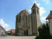
- Gotische Kirche Saint-Thibault, seit 1840 ein Monument historique
Weblinks
Commons: Saint-Thibault – Sammlung von Bildern, Videos und Audiodateien

Kirche Saint-Thibault
This article is issued from Wikipedia. The text is licensed under Creative Commons - Attribution - Sharealike. The authors of the article are listed here. Additional terms may apply for the media files, click on images to show image meta data.
