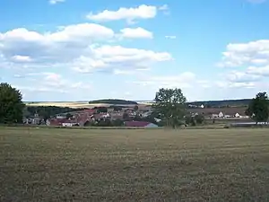
Moitron
Moitron ist eine französische Gemeinde mit 59 Einwohnern (Stand 1. Januar 2019) im Département Côte-d’Or in der Region Bourgogne-Franche-Comté. Sie gehört zum Kanton Châtillon-sur-Seine und zum Arrondissement Montbard.
| Moitron | ||
|---|---|---|
.svg.png.webp)
|
| |
| Staat | Frankreich | |
| Region | Bourgogne-Franche-Comté | |
| Département (Nr.) | Côte-d’Or (21) | |
| Arrondissement | Montbard | |
| Kanton | Châtillon-sur-Seine | |
| Gemeindeverband | Communauté de communes du Pays Châtillonnais | |
| Koordinaten | 47° 41′ N, 4° 49′ O | |
| Höhe | 335–469 m | |
| Fläche | 15,40 km² | |
| Einwohner | 59 (1. Januar 2019) | |
| Bevölkerungsdichte | 4 Einw./km² | |
| Postleitzahl | 21510 | |
| INSEE-Code | 21418 | |
 Moitron | ||

Geografie
Die ehemalige Route nationale 454 führt über Moitron.
Nachbargemeinden sind Montmoyen im Norden, Saint-Broing-les-Moines im Nordosten, Minot im Südosten, Étalante im Süden und Aignay-le-Duc im Westen.
Bevölkerungsentwicklung
| Jahr | 1962 | 1968 | 1975 | 1982 | 1990 | 1999 | 2008 | 2015 | |
|---|---|---|---|---|---|---|---|---|---|
| Einwohner | 90 | 89 | 85 | 74 | 58 | 47 | 58 | 61 | |
| Quellen: Cassini und INSEE | |||||||||
Weblinks
Commons: Moitron – Sammlung von Bildern, Videos und Audiodateien

Kirche Saint-Léger, seit 1991 ein Monument historique
This article is issued from Wikipedia. The text is licensed under Creative Commons - Attribution - Sharealike. The authors of the article are listed here. Additional terms may apply for the media files, click on images to show image meta data.