Saint-Maurice-Montcouronne
Saint-Maurice-Montcouronne ist eine französische Gemeinde mit 1.544 Einwohnern (Stand: 1. Januar 2019) im Département Essonne in der Region Île-de-France; sie gehört zum Arrondissement Palaiseau und zum Kanton Dourdan (bis 2015: Kanton Saint-Chéron). Die Einwohner heißen Saint-Mauriciens.
| Saint-Maurice-Montcouronne | ||
|---|---|---|
.svg.png.webp)
|
| |
| Staat | Frankreich | |
| Region | Île-de-France | |
| Département (Nr.) | Essonne (91) | |
| Arrondissement | Palaiseau | |
| Kanton | Dourdan | |
| Gemeindeverband | Pays de Limours | |
| Koordinaten | 48° 35′ N, 2° 7′ O | |
| Höhe | 54–157 m | |
| Fläche | 9,12 km² | |
| Einwohner | 1.544 (1. Januar 2019) | |
| Bevölkerungsdichte | 169 Einw./km² | |
| Postleitzahl | 91530 | |
| INSEE-Code | 91568 | |
| Website | http://www.mairie-saint-maurice-montcouronne.fr/accueil.php | |
_mairie_1099a.jpg.webp) Rathaus (Mairie) von Saint-Maurice-Montcouronne | ||

Geographie
Saint-Maurice-Montcouronne liegt etwa 34 Kilometer südsüdwestlich von Paris am Fluss Rémarde und seinem Zufluss Prédecelle. Umgeben wird Saint-Maurice-Montcouronne von den Nachbargemeinden Vaugrigneuse im Norden und Nordwesten, Courson-Monteloup im Norden und Nordosten, Bruyères-le-Châtel im Osten, Breuillet im Südosten, Saint-Chéron im Süden sowie Le Val-Saint-Germain im Westen.
Bevölkerungsentwicklung
| Jahr | 1962 | 1968 | 1975 | 1982 | 1990 | 1999 | 2006 | 2012 |
| Einwohner | 273 | 320 | 715 | 917 | 1.279 | 1.360 | 1.549 | 1.611 |
| Quelle: Cassini und INSEE | ||||||||
Sehenswürdigkeiten
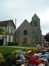
Kirche Saint-Maurice
- Kirche Saint-Maurice aus dem 12. Jahrhundert
- Haus Eudoxie Dervillé, Ende des 19. Jahrhunderts erbaut
- Haus La Belle-Étoile, 1795 erbaut
Literatur
- Le Patrimoine des Communes de l’Essonne. Flohic Éditions, Band 2, Paris 2001, ISBN 2-84234-126-0, S. 888–887.
This article is issued from Wikipedia. The text is licensed under Creative Commons - Attribution - Sharealike. The authors of the article are listed here. Additional terms may apply for the media files, click on images to show image meta data.