Saint-Georges-la-Pouge
Saint-Georges-la-Pouge ist eine Gemeinde im Zentralmassiv in Frankreich. Sie gehört zur Region Nouvelle-Aquitaine, zum Département Creuse, zum Arrondissement Guéret und zum Kanton Ahun.
| Saint-Georges-la-Pouge | ||
|---|---|---|
| ||
| Staat | Frankreich | |
| Region | Nouvelle-Aquitaine | |
| Département (Nr.) | Creuse (23) | |
| Arrondissement | Guéret | |
| Kanton | Ahun | |
| Gemeindeverband | Creuse Sud Ouest | |
| Koordinaten | 46° 0′ N, 1° 58′ O | |
| Höhe | 470–636 m | |
| Fläche | 24,03 km² | |
| Einwohner | 369 (1. Januar 2019) | |
| Bevölkerungsdichte | 15 Einw./km² | |
| Postleitzahl | 23250 | |
| INSEE-Code | 23197 | |
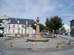 Rathaus (Mairie) | ||

Geographie
Das Gemeindegebiet wird vom Fluss Gosne durchquert, Sie grenzt im Norden an La Chapelle-Saint-Martial und Le Donzeil, im Osten an Saint-Sulpice-les-Champs, im Süden an Chavanat und La Pouge sowie im Westen an Saint-Hilaire-le-Château.
Bevölkerungsentwicklung
| Jahr | 1962 | 1968 | 1975 | 1982 | 1990 | 1999 | 2006 | 2012 |
|---|---|---|---|---|---|---|---|---|
| Einwohner | 465 | 495 | 427 | 418 | 328 | 311 | 334 | 357 |

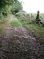 Römerstraße in Saint-Georges-la-Pouge
This article is issued from Wikipedia. The text is licensed under Creative Commons - Attribution - Sharealike. The authors of the article are listed here. Additional terms may apply for the media files, click on images to show image meta data.