Saint-Pierre-Bellevue
Saint-Pierre-Bellevue ist eine Gemeinde im Zentralmassiv in Frankreich. Sie gehört zur Region Nouvelle-Aquitaine, zum Département Creuse, zum Arrondissement Guéret und zum Kanton Bourganeuf.
| Saint-Pierre-Bellevue | ||
|---|---|---|
| ||
| Staat | Frankreich | |
| Region | Nouvelle-Aquitaine | |
| Département (Nr.) | Creuse (23) | |
| Arrondissement | Guéret | |
| Kanton | Bourganeuf | |
| Gemeindeverband | Creuse Sud Ouest | |
| Koordinaten | 45° 55′ N, 1° 53′ O | |
| Höhe | 512–808 m | |
| Fläche | 32,83 km² | |
| Einwohner | 209 (1. Januar 2019) | |
| Bevölkerungsdichte | 6 Einw./km² | |
| Postleitzahl | 23460 | |
| INSEE-Code | 23232 | |

Geographie
Sie grenzt im Norden an Vidaillat, im Osten an Le Monteil-au-Vicomte, im Süden an Royère-de-Vassivière und im Westen an Saint-Pardoux-Morterolles. Der Bach namens Tourtoulloux kommt vom Ortsteil Compeix.
Geschichte
Bis 1829 waren Compeix und Saint-Pierre-le-Bost zwei eigenständige Gemeinden. Sie fusionierten zu Saint-Pierre-Bellevue.
Bevölkerungsentwicklung
| Jahr | 1962 | 1968 | 1975 | 1982 | 1990 | 1999 | 2008 | 2013 |
|---|---|---|---|---|---|---|---|---|
| Einwohner | 442 | 347 | 325 | 330 | 302 | 239 | 233 | 222 |
Sehenswürdigkeiten
- Kirche Saint-Pierre
- Kirche Saint-Étienne im Ortsteil Le Compeix
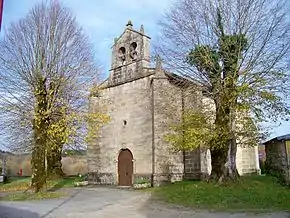
Kirche Saint-Étienne
This article is issued from Wikipedia. The text is licensed under Creative Commons - Attribution - Sharealike. The authors of the article are listed here. Additional terms may apply for the media files, click on images to show image meta data.