Saint-Coutant-le-Grand
| Saint-Coutant-le-Grand | ||
|---|---|---|
.svg.png.webp)
|
| |
| Staat | Frankreich | |
| Region | Nouvelle-Aquitaine | |
| Département (Nr.) | Charente-Maritime (17) | |
| Arrondissement | Rochefort | |
| Kanton | Tonnay-Charente | |
| Gemeindeverband | Rochefort Océan | |
| Koordinaten | 45° 57′ N, 0° 46′ W | |
| Höhe | 1–45 m | |
| Fläche | 12,99 km² | |
| Einwohner | 413 (1. Januar 2019) | |
| Bevölkerungsdichte | 32 Einw./km² | |
| Postleitzahl | 17430 | |
| INSEE-Code | 17320 | |
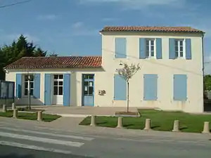 Rathaus (Mairie) von Saint-Coutant-le-Grand | ||

Saint-Coutant-le-Grand ist eine französische Gemeinde mit 413 Einwohnern (Stand: 1. Januar 2019) im Département Charente-Maritime in der Region Nouvelle-Aquitaine. Saint-Coutant-le-Grand gehört zum Arrondissement Rochefort und zum Kanton Tonnay-Charente. Die Einwohner werden Saint-Coutantais genannt.
Geographie
Saint-Coutant-le-Grand liegt etwa 14 Kilometer ostnordöstlich vom Stadtzentrum von Rochefort an der Boutonne, die die Gemeinde im Süden begrenzt. Umgeben wird Saint-Coutant-le-Grand von den Nachbargemeinden Moragne im Norden, Tonnay-Boutonne im Nordosten, Puy-du-Lac im Osten und Südosten, Champdolent im Süden sowie Lussant im Westen.
Bevölkerungsentwicklung
| Jahr | 1962 | 1968 | 1975 | 1982 | 1990 | 1999 | 2008 | 2013 |
|---|---|---|---|---|---|---|---|---|
| Einwohner | 305 | 337 | 338 | 306 | 293 | 279 | 336 | 411 |
| Quelle: Cassini und INSEE | ||||||||
Sehenswürdigkeiten
- Kirche

Kirche
Weblinks
Commons: Saint-Coutant-le-Grand – Sammlung von Bildern, Videos und Audiodateien
This article is issued from Wikipedia. The text is licensed under Creative Commons - Attribution - Sharealike. The authors of the article are listed here. Additional terms may apply for the media files, click on images to show image meta data.