Montholon (Yonne)
Montholon ist eine französische Gemeinde mit 2.856 Einwohnern (Stand: 1. Januar 2019) im Département Yonne in der Region Bourgogne-Franche-Comté; sie gehört zum Arrondissement Auxerre. Die Gemeinde gehört zum Kanton Charny.
| Montholon | ||
|---|---|---|
| ||
| Staat | Frankreich | |
| Region | Bourgogne-Franche-Comté | |
| Département (Nr.) | Yonne (89) | |
| Arrondissement | Auxerre | |
| Kanton | Charny | |
| Gemeindeverband | Aillantais | |
| Koordinaten | 47° 53′ N, 3° 21′ O | |
| Höhe | 85–241 m | |
| Fläche | 49,70 km² | |
| Einwohner | 2.856 (1. Januar 2019) | |
| Bevölkerungsdichte | 57 Einw./km² | |
| Postleitzahl | 89110, 89710 | |
| INSEE-Code | 89003 | |
Geographie
Montholon liegt etwa 20 Kilometer nordwestlich von Auxerre am Tholon. Umgeben wird Montholon von den Nachbargemeinden Béon und Chamvres im Norden, Paroy-sur-Tholon, Champlay und Senan im Nordosten, Valravillon im Osten, Poilly-sur-Tholon im Südosten, Chassy im Süden, La Ferté-Loupière im Westen sowie Sépeaux-Saint Romain im Westen und Nordwesten.
Durch die Gemeinde führt die Autoroute A6.
Gliederung
| Ortsteil | ehemaliger INSEE-Code | Fläche (km²) | Einwohnerzahl (2019)[1] |
|---|---|---|---|
| Aillant-sur-Tholon (Verwaltungssitz) | 89003 | 18,23 | 1.407 |
| Champvallon | 89078 | 6,59 | 641 |
| Villiers-sur-Tholon | 89473 | 15,56 | 459 |
| Volgré | 89484 | 9,32 | 349 |
Sehenswürdigkeiten
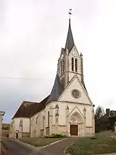
- Kirche Saint-Martin in Aillant-sur-Tholon, seit 1987 Monument historique
- Kirche von Champvallon
- Kirche Saint-Jean-Baptiste in Villiers-sur-Tholon, seit 1976 Monument historique
- Kirche von Volgré
 Kirche Saint-Martin
 Kirche von Champvallon
 Kirche Saint-Jean-Baptiste
 Kirche von Volgré
Weblinks
Commons: Montholon – Sammlung von Bildern, Videos und Audiodateien
This article is issued from Wikipedia. The text is licensed under Creative Commons - Attribution - Sharealike. The authors of the article are listed here. Additional terms may apply for the media files, click on images to show image meta data.
