Les Hauts de Forterre
Les Hauts de Forterre ist eine französische Gemeinde mit 499 Einwohnern (Stand: 1. Januar 2019) im Département Yonne in der Region Bourgogne-Franche-Comté; sie gehört zum Arrondissement Auxerre. Die Gemeinde gehört zum Kanton Vincelles.
| Les Hauts de Forterre | ||
|---|---|---|
| ||
| Staat | Frankreich | |
| Region | Bourgogne-Franche-Comté | |
| Département (Nr.) | Yonne (89) | |
| Arrondissement | Auxerre | |
| Kanton | Vincelles | |
| Gemeindeverband | Puisaye-Forterre | |
| Koordinaten | 47° 37′ N, 3° 24′ O | |
| Höhe | 224–386 m | |
| Fläche | 33,17 km² | |
| Einwohner | 499 (1. Januar 2019) | |
| Bevölkerungsdichte | 15 Einw./km² | |
| Postleitzahl | 89560 | |
| INSEE-Code | 89405 | |
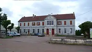
 Rathaus von Les Hauts de Forterre | ||
Geographie
Les Hauts de Forterre liegt etwa 25 Kilometer südwestlich von Auxerre. Umgeben wird Les Hauts de Forterre von den Nachbargemeinden Ouanne im Norden, Merry-Sec im Nordosten, Courson-les-Carrières im Osten, Druyes-les-Belles-Fontaines im Süden, Sougères-en-Puisaye im Südwesten sowie Sementron im Westen und Nordwesten.
Gliederung
| Ortsteil | ehemaliger INSEE-Code | Fläche (km²) | Einwohnerzahl (2019)[1] |
|---|---|---|---|
| Fontenailles | 89174 | 2,82 | 66 |
| Molesmes | 89260 | 9,48 | 172 |
| Taingy (Verwaltungssitz) | 89405 | 20,87 | 261 |
Sehenswürdigkeiten
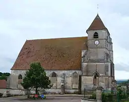
- Kirche Saint-Martin in Taingy, Monument historique seit 1926
- Kirche Saint-Léger in Fontenailles
- Kirche Notre-Dame von Molesmes, Monument historique
 Kirche Saint-Martin
 Kirche Notre-Dame
Weblinks
Commons: Les Hauts de Forterre – Sammlung von Bildern, Videos und Audiodateien
This article is issued from Wikipedia. The text is licensed under Creative Commons - Attribution - Sharealike. The authors of the article are listed here. Additional terms may apply for the media files, click on images to show image meta data.
