La Chapelle-aux-Naux
La Chapelle-aux-Naux ist eine französische Gemeinde mit 569 Einwohnern (Stand: 1. Januar 2019) im Département Indre-et-Loire in der Region Centre-Val de Loire. Sie gehört zum Arrondissement Tours und zum Kanton Chinon (bis 2015: Kanton Azay-le-Rideau). Die Einwohner werden Chapellauniens genannt.
| La Chapelle-aux-Naux | ||
|---|---|---|
| ||
| Staat | Frankreich | |
| Region | Centre-Val de Loire | |
| Département (Nr.) | Indre-et-Loire (37) | |
| Arrondissement | Tours | |
| Kanton | Chinon | |
| Gemeindeverband | Touraine Vallée de l’Indre | |
| Koordinaten | 47° 19′ N, 0° 26′ O | |
| Höhe | 36–41 m | |
| Fläche | 5,35 km² | |
| Einwohner | 569 (1. Januar 2019) | |
| Bevölkerungsdichte | 106 Einw./km² | |
| Postleitzahl | 37130 | |
| INSEE-Code | 37056 | |
| Website | https://www.lachapelleauxnaux.com/ | |
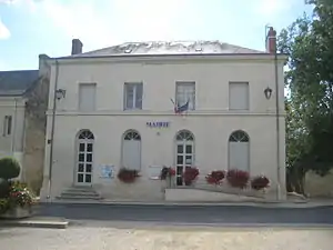 Rathaus (Mairie) von La Chapelle-aux-Naux | ||

Geographie
La Chapelle-aux-Naux liegt in der Touraine zwischen der Loire, die die nördliche Gemeindegrenze bildet, und dem Vieux Cher, der die Gemeinde im Süden begrenzt. Umgeben wird La Chapelle-aux-Naux von den Nachbargemeinden Langeais im Norden, Villandry im Nordosten, Vallères im Osten, Lignières-de-Touraine im Süden sowie Bréhémont im Westen.
Bevölkerungsentwicklung
| Jahr | 1962 | 1968 | 1975 | 1982 | 1990 | 1999 | 2006 | 2017 |
| Einwohner | 460 | 428 | 421 | 402 | 458 | 496 | 522 | 571 |
| Quellen: Cassini und INSEE | ||||||||
Sehenswürdigkeiten
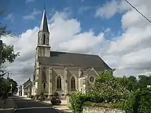
Kirche Saint-Clément
- Kirche Saint-Clément
Literatur
- Le Patrimoine des Communes d’Indre-et-Loire. Flohic Editions, Band 1, Paris 2001, ISBN 2-84234-115-5, S. 110–112.
Weblinks
Commons: La Chapelle-aux-Naux – Sammlung von Bildern, Videos und Audiodateien
This article is issued from Wikipedia. The text is licensed under Creative Commons - Attribution - Sharealike. The authors of the article are listed here. Additional terms may apply for the media files, click on images to show image meta data.