La Chapelle-Heulin
La Chapelle-Heulin (bretonisch: Chapel-Huelin) ist eine französische Gemeinde mit 3357 Einwohnern (Stand: 1. Januar 2019) im Département Loire-Atlantique in der Region Pays de la Loire; sie gehört zum Arrondissement Nantes und zum Kanton Vallet. Die Einwohner werden Huelinois(es) genannt.
| La Chapelle-Heulin | ||
|---|---|---|
.svg.png.webp)
|
| |
| Staat | Frankreich | |
| Region | Pays de la Loire | |
| Département (Nr.) | Loire-Atlantique (44) | |
| Arrondissement | Nantes | |
| Kanton | Vallet | |
| Gemeindeverband | Sèvre et Loire | |
| Koordinaten | 47° 11′ N, 1° 20′ W | |
| Höhe | 2–37 m | |
| Fläche | 13,54 km² | |
| Einwohner | 3.357 (1. Januar 2019) | |
| Bevölkerungsdichte | 248 Einw./km² | |
| Postleitzahl | 44330 | |
| INSEE-Code | 44032 | |
| Website | http://www.mairie-lachapelleheulin.fr/ | |
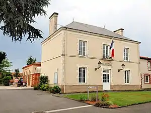 Mairie | ||

Geografie
La Chapelle-Heulin liegt etwa 22 Kilometer östlich von Nantes. Umgeben wird La Chapelle-Heulin von den Nachbargemeinden Le Loroux-Bottereau im Norden, Le Landreau im Norden und Nordosten, Vallet im Osten, Le Pallet im Süden, La Haie-Fouassière im Südwesten sowie Haute-Goulaine im Westen. La Chapelle-Heulin gehört zum Weinbaugebiet Sèvre-et-Maine und ist bekannt für Muscadet- und Gros-Plant-Weine. Durch die Gemeinde führt die Route nationale 249.
Bevölkerungsentwicklung
| Jahr | 1962 | 1968 | 1975 | 1982 | 1990 | 1999 | 2006 | 2017 |
|---|---|---|---|---|---|---|---|---|
| Einwohner | 1216 | 1212 | 1307 | 1800 | 1838 | 1859 | 2715 | 3263 |
Sehenswürdigkeiten
- Kirche Saint-Eutrope
- Kapelle Saint-Joseph
- Grotte von La Bernadière
Literatur
- Le Patrimoine des Communes de la Loire-Atlantique. Flohic Editions, Band 2, Charenton-le-Pont 1999, ISBN 2-84234-040-X, S. 1281–1286.
This article is issued from Wikipedia. The text is licensed under Creative Commons - Attribution - Sharealike. The authors of the article are listed here. Additional terms may apply for the media files, click on images to show image meta data.