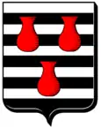
Favières (Meurthe-et-Moselle)
| Favières | ||
|---|---|---|

|
| |
| Staat | Frankreich | |
| Region | Grand Est | |
| Département (Nr.) | Meurthe-et-Moselle (54) | |
| Arrondissement | Toul | |
| Kanton | Meine au Saintois | |
| Gemeindeverband | Pays de Colombey et du Sud Toulois | |
| Koordinaten | 48° 28′ N, 5° 57′ O | |
| Höhe | 308–471 m | |
| Fläche | 29,91 km² | |
| Einwohner | 597 (1. Januar 2019) | |
| Bevölkerungsdichte | 20 Einw./km² | |
| Postleitzahl | 54115 | |
| INSEE-Code | 54189 | |
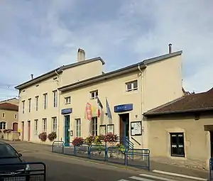
 Rathaus (Mairie) von Favières | ||
Favières ist eine französische Gemeinde mit 597 Einwohnern (Stand: 1. Januar 2019) im Département Meurthe-et-Moselle in der Region Grand Est (vor 2016 Lothringen). Die Gemeinde liegt im Arrondissement Toul, ist Teil der Communauté de communes du Pays de Colombey et du Sud Toulois und gehört zum Kanton Meine au Saintois.
Geographie
Favières liegt etwa 34 Kilometer südwestlich von Nancy. Nachbargemeinden von Favières sind Selaincourt und Saulxerotte im Norden, Dolcourt im Nordosten, Lalœuf im Nordosten und Osten, Gélaucourt im Osten, Battigny im Osten und Südosten, Vandeléville im Südosten, Tramont-Émy, Tramont-Saint-André und Aroffe im Süden, Gémonville im Südwesten sowie Harmonville im Westen.
Einwohner
| 1962 | 1968 | 1975 | 1982 | 1990 | 1999 | 2006 | 2019 | |
|---|---|---|---|---|---|---|---|---|
| 617 | 606 | 560 | 543 | 533 | 501 | 568 | 597 | |
| Quellen: Cassini und INSEE | ||||||||
Sehenswürdigkeiten
- Kirche Saint-Antoine-et-Saint-Sulpice aus dem 18. Jahrhundert
- Kapelle aus dem 18./19. Jahrhundert
- Wassermühle aus dem 16. Jahrhundert
- zwei Waschhäuser (Lavoirs)
 Kirche Saint-Antoine-et-Saint-Sulpice
 Waschhaus
 Waschhaus
Persönlichkeiten
- Ambroise-Auguste Liébeault (1823–1904), Landarzt und Psychotherapeut
This article is issued from Wikipedia. The text is licensed under Creative Commons - Attribution - Sharealike. The authors of the article are listed here. Additional terms may apply for the media files, click on images to show image meta data.
