Wyoming County (New York)
Wyoming County[1] ist ein County im Bundesstaat New York der Vereinigten Staaten. Bei der Volkszählung im Jahr 2010 hatte Wyoming County 42.155 Einwohner und eine Bevölkerungsdichte von 27,5 Einwohnern pro Quadratkilometer. Der Verwaltungssitz (County Seat) ist Warsaw.
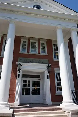 Wyoming County Courthouse (2013) | |
| Verwaltung | |
|---|---|
| US-Bundesstaat: | New York |
| Verwaltungssitz: | Warsaw |
| Gründung: | 19. Mai 1841 |
| Gebildet aus: | Genesee County |
| Vorwahl: | 001 585 |
| Demographie | |
| Einwohner: | 42.155 (2010) |
| Bevölkerungsdichte: | 27,46 Einwohner/km2 |
| Geographie | |
| Fläche gesamt: | 1.544,4 km² |
| Wasserfläche: | 9,2 km² |
| Karte | |
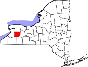 Karte von Wyoming County innerhalb von New York | |
| Website: www.wyomingco.net | |
Geographie
Das County hat eine Fläche von 1.544,4 Quadratkilometern, wovon 9,2 Quadratkilometer Wasserfläche sind.
.svg.png.webp)
Geschichte
Wyoming County wurde am 19. Mai 1841 von Genesee County abgetrennt. Damit waren die administrativen Teilungen im Westteil des Bundesstaates New York abgeschlossen.
Zum 21. April 2017 waren im 19 Anwesen und 7 Historic Districts in das National Register of Historic Places eingetragen.
Einwohnerentwicklung
| Jahr | 1800 | 1810 | 1820 | 1830 | 1840 | 1850 | 1860 | 1870 | 1880 | 1890 |
|---|---|---|---|---|---|---|---|---|---|---|
| Einwohner | – | – | – | – | – | 31.981 | 31.968 | 29.164 | 30.907 | 31.193 |
| Jahr | 1900 | 1910 | 1920 | 1930 | 1940 | 1950 | 1960 | 1970 | 1980 | 1990 |
| Einwohner | 30.413 | 31.880 | 30.314 | 28.764 | 31.349 | 32.822 | 34.793 | 37.688 | 39.895 | 42.507 |
| Jahr | 2000 | 2010 | 2020 | 2030 | 2040 | 2050 | 2060 | 2070 | 2080 | 2090 |
| Einwohner | 43.424 | 42.155 |
Städte und Ortschaften
Zusätzlich zu den unten angeführten selbständigen Gemeinden gibt es im Wyoming County mehrere villages.
| Ortschaft | Status | Einwohner (2010)[3] | Gesamte Fläche [km²][4] | Landfläche [km²][4] | Bevölkerungsdichte [Einwohner / km²] | Gründung[5] | Besonderheit |
|---|---|---|---|---|---|---|---|
| Arcade | town | 4.205 | 122,0 | 121,7 | 34,6 | 6. März 1818 | Gegründet unter dem Namen China; umbenannt am 9. November 1869 |
| Attica | town | 7.702 | 93,3 | 92,5 | 83,3 | 4. Apr. 1811 | |
| Bennington | town | 3.359 | 143,1 | 142,6 | 23,6 | 6. März 1818 | |
| Castile | town | 2.906 | 99,4 | 95,8 | 30,3 | 27. Feb. 1821 | |
| Covington | town | 1.232 | 67,7 | 67,7 | 45,6 | 31. Jan. 1817 | |
| Eagle | town | 1.192 | 94,5 | 94,0 | 12,7 | 21. Jan. 1823 | |
| Gainesville | town | 2.182 | 92,5 | 92,1 | 23,7 | 25. Feb. 1814 | Gegründet unter dem Namen Hebe; umbenannt am 17. April 1816 |
| Genesee Falls | town | 438 | 40,7 | 40,4 | 10,8 | 1. Apr. 1846 | |
| Java | town | 2.057 | 122,6 | 122,1 | 16,8 | 20. Apr. 1832 | |
| Middlebury | town | 1.441 | 92,4 | 92,3 | 15,6 | 20. März 1812 | |
| Orangeville | town | 1.355 | 92,3 | 92,1 | 14,7 | 14. Feb. 1816 | |
| Perry | town | 4.616 | 94,9 | 94,3 | 49,0 | 11. März 1814 | |
| Pike | town | 1.114 | 80,9 | 80,5 | 13,8 | 6. März 1818 | |
| Sheldon | town | 2.409 | 122,7 | 122,6 | 19,6 | 19. März 1808 | |
| Warsaw | town | 5.064 | 91,9 | 91,7 | 55,2 | 19. März 1808 | County Seat |
| Wethersfield | town | 883 | 93,5 | 92,7 | 9,5 | 12. Apr. 1823 |
Literatur
- Franklin Benjamin Hough: Gazetteer of the State of New York. Band 2. A. Boyd, Albany NY 1873, S. 711 ff. (englisch, Textarchiv – Internet Archive).
Weblinks
Einzelnachweise
- Wyoming County im Geographic Names Information System des United States Geological Survey
- Einwohnerzahl 1850–2010 laut Volkszählungsergebnissen
- Einwohnerdaten aus dem US-Census von 2010 im American Factfinder
- Offizielle Daten. United States Board on Geographic Names
- Franklin Benjamin Hough: Gazetteer of the State of New York. Band 2. A. Boyd, Albany NY 1873, S. 713 ff. (englisch).
Liste der Countys in New York
Albany |
Allegany |
Bronx |
Broome |
Cattaraugus |
Cayuga |
Chautauqua |
Chemung |
Chenango |
Clinton |
Columbia |
Cortland |
Delaware |
Dutchess |
Erie |
Essex |
Franklin |
Fulton |
Genesee |
Greene |
Hamilton |
Herkimer |
Jefferson |
Kings (Brooklyn) |
Lewis |
Livingston |
Madison |
Monroe |
Montgomery |
Nassau |
New York (Manhattan) |
Niagara |
Oneida |
Onondaga |
Ontario |
Orange |
Orleans |
Oswego |
Otsego |
Putnam |
Queens |
Rensselaer |
Richmond (Staten Island) |
Rockland |
Saratoga |
Schenectady |
Schoharie |
Schuyler |
Seneca |
St. Lawrence |
Steuben |
Suffolk |
Sullivan |
Tioga |
Tompkins |
Ulster |
Warren |
Washington |
Wayne |
Westchester |
Wyoming |
Yates