Saulon-la-Chapelle
Saulon-la-Chapelle ist eine französische Gemeinde mit 969 Einwohnern (Stand 1. Januar 2019) im Département Côte-d’Or in der Region Bourgogne-Franche-Comté. Sie gehört zum Arrondissement Beaune und zum Kanton Nuits-Saint-Georges.
| Saulon-la-Chapelle | ||
|---|---|---|
.svg.png.webp)
|
| |
| Staat | Frankreich | |
| Region | Bourgogne-Franche-Comté | |
| Département (Nr.) | Côte-d’Or (21) | |
| Arrondissement | Beaune | |
| Kanton | Nuits-Saint-Georges | |
| Gemeindeverband | Gevrey-Chambertin et de Nuits-Saint-Georges | |
| Koordinaten | 47° 13′ N, 5° 5′ O | |
| Höhe | 197–226 m | |
| Fläche | 10,01 km² | |
| Einwohner | 969 (1. Januar 2019) | |
| Bevölkerungsdichte | 97 Einw./km² | |
| Postleitzahl | 21910 | |
| INSEE-Code | 21585 | |

Geographie
Nachbargemeinden von Saulon-la-Chapelle sind Bretenière im Norden, Thorey-en-Plaine und Longecourt-en-Plaine im Osten, Izeure im Südosten, Noiron-sous-Gevrey im Süden, Saulon-la-Rue und Barges im Westen, sowie Fénay im Nordwesten.
Bevölkerungsentwicklung
| Jahr | 1962 | 1968 | 1975 | 1982 | 1990 | 1999 | 2011 | ||
| Einwohner | 908 | 965 | 1000 | 868 | 810 | 927 | 1.039 | ||
| Quellen: Cassini und INSEE | |||||||||
Weblinks
Commons: Saulon-la-Chapelle – Sammlung von Bildern, Videos und Audiodateien
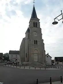
Kirche Saint-Sébastien
This article is issued from Wikipedia. The text is licensed under Creative Commons - Attribution - Sharealike. The authors of the article are listed here. Additional terms may apply for the media files, click on images to show image meta data.