Sainte-Marthe (Lot-et-Garonne)
Sainte-Marthe (gaskognisch Senta Marta) ist eine französische Gemeinde mit 645 Einwohnern (Stand 1. Januar 2019) im Département Lot-et-Garonne in der Region Nouvelle-Aquitaine (vor 2016 Aquitaine). Die Gemeinde gehört zum Arrondissement Marmande und zum Kanton Les Forêts de Gascogne (bis 2015 Le Mas-d’Agenais). Die Einwohner werden Saint-Marthais genannt.
| Sainte-Marthe Senta Marta | ||
|---|---|---|
| ||
| Staat | Frankreich | |
| Region | Nouvelle-Aquitaine | |
| Département (Nr.) | Lot-et-Garonne (47) | |
| Arrondissement | Marmande | |
| Kanton | Les Forêts de Gascogne | |
| Gemeindeverband | Val de Garonne Agglomération | |
| Koordinaten | 44° 25′ N, 0° 9′ O | |
| Höhe | 28–94 m | |
| Fläche | 9,73 km² | |
| Einwohner | 645 (1. Januar 2019) | |
| Bevölkerungsdichte | 66 Einw./km² | |
| Postleitzahl | 47430 | |
| INSEE-Code | 47253 | |
| Website | http://mairie-saintemarthe.fr/ | |
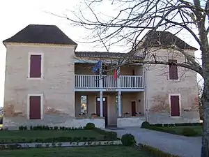 Rathaus (Mairie) von Sainte-Marthe | ||

Geografie
Sainte-Marthe liegt etwa 75 Kilometer südöstlich von Bordeaux. Umgeben wird Sainte-Marthe von den Nachbargemeinden Fourques-sur-Garonne im Norden, Caumont-sur-Garonne im Osten, Le Mas-d’Agenais im Südosten, Sainte-Gemme-Martaillac und Grézet-Cavagnan im Süden, Bouglon im Südwesten sowie Samazan im Westen und Nordwesten.
Durch die Gemeinde führt die Autoroute A62.
Bevölkerungsentwicklung
| Jahr | 1962 | 1968 | 1975 | 1982 | 1990 | 1999 | 2006 | 2013 |
| Einwohner | 393 | 364 | 302 | 306 | 381 | 383 | 460 | 550 |
| Quelle: Cassini und INSEE | ||||||||
Sehenswürdigkeiten
- Kirche Sainte-Marthe aus dem 11. Jahrhundert
- Kirche Saint-Sauveur aus dem 17. Jahrhundert
- Schloss Lanauze, 1751 bis 1754 erbaut, Monument historique seit 1978
 Kirche Sainte-Marthe
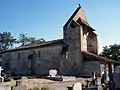 Kirche Saint-Sauveur
This article is issued from Wikipedia. The text is licensed under Creative Commons - Attribution - Sharealike. The authors of the article are listed here. Additional terms may apply for the media files, click on images to show image meta data.