Palluel
Palluel ist eine Gemeinde im französischen Département Pas-de-Calais in der Region Hauts-de-France. Sie gehört zum Kanton Bapaume (bis 2015 Kanton Marquion) im Arrondissement Arras. Die Bewohner nennen sich Palluelois.
| Palluel | ||
|---|---|---|
| ||
| Staat | Frankreich | |
| Region | Hauts-de-France | |
| Département (Nr.) | Pas-de-Calais (62) | |
| Arrondissement | Arras | |
| Kanton | Bapaume | |
| Gemeindeverband | Osartis Marquion | |
| Koordinaten | 50° 16′ N, 3° 6′ O | |
| Höhe | 34–60 m | |
| Fläche | 2,82 km² | |
| Einwohner | 570 (1. Januar 2019) | |
| Bevölkerungsdichte | 202 Einw./km² | |
| Postleitzahl | 62860 | |
| INSEE-Code | 62646 | |
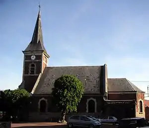 Kirche Notre-Dame-de-la-Visitation | ||

Geografie
Östlich des Dorfkerns verläuft der Canal du Nord durch die Gemeindegemarkung. Im Westen verläuft die Grenze zu Écourt-Saint-Quentin durch einen See namens Marais du Grand Clais. Die weiteren Nachbargemeinden sind Hamel (Berührungspunkt) im Nordwesten, Arleux im Norden und Oisy-le-Verger im Osten und Süden.
Bevölkerungsentwicklung
| Jahr | 1962 | 1968 | 1975 | 1982 | 1990 | 1999 | 2008 | 2013 |
|---|---|---|---|---|---|---|---|---|
| Einwohner | 479 | 508 | 522 | 565 | 525 | 520 | 564 | 549 |
This article is issued from Wikipedia. The text is licensed under Creative Commons - Attribution - Sharealike. The authors of the article are listed here. Additional terms may apply for the media files, click on images to show image meta data.