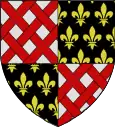
Ytres
| Ytres | ||
|---|---|---|

|
| |
| Staat | Frankreich | |
| Region | Hauts-de-France | |
| Département (Nr.) | Pas-de-Calais (62) | |
| Arrondissement | Arras | |
| Kanton | Bapaume | |
| Gemeindeverband | Sud-Artois | |
| Koordinaten | 50° 4′ N, 3° 0′ O | |
| Höhe | 94–133 m | |
| Fläche | 4,34 km² | |
| Einwohner | 434 (1. Januar 2019) | |
| Bevölkerungsdichte | 100 Einw./km² | |
| Postleitzahl | 62124 | |
| INSEE-Code | 62909 | |
Ytres ist eine Gemeinde im französischen Département Pas-de-Calais in der Region Hauts-de-France. Sie gehört zum Kanton Bapaume (bis 2015 Kanton Bertincourt) im Arrondissement Arras. Die Bewohner nennen sich Ytriens.
Geografie
Durch Ytres führt die Route nationale 2 und die Autoroute A2. Ebenfalls über Ytres führt der Canal du Nord. Die Gemeinde grenzt im Nordwesten an Bus, im Norden an Bertincourt, im Nordosten an Ruyaulcourt, im Osten an Neuville-Bourjonval, im Südosten an Équancourt, im Süden an Étricourt-Manancourt und im Westen an Léchelle.
Bevölkerungsentwicklung
| Jahr | 1962 | 1968 | 1975 | 1982 | 1990 | 1999 | 2008 | 2013 |
|---|---|---|---|---|---|---|---|---|
| Einwohner | 438 | 442 | 396 | 354 | 361 | 393 | 421 | 437 |
This article is issued from Wikipedia. The text is licensed under Creative Commons - Attribution - Sharealike. The authors of the article are listed here. Additional terms may apply for the media files, click on images to show image meta data.
