Lourenties
Lourenties (okzitanisch: Hlorentias) ist eine französische Gemeinde mit 391 Einwohnern (Stand: 1. Januar 2019) im Département Pyrénées-Atlantiques in der Region Nouvelle-Aquitaine. Sie gehört zum Arrondissement Pau und ist Teil des Kantons Vallées de l’Ousse et du Lagoin (bis 2015: Kanton Pontacq).
| Lourenties | ||
|---|---|---|
| ||
| Staat | Frankreich | |
| Region | Nouvelle-Aquitaine | |
| Département (Nr.) | Pyrénées-Atlantiques (64) | |
| Arrondissement | Pau | |
| Kanton | Vallées de l’Ousse et du Lagoin | |
| Gemeindeverband | Nord Est Béarn | |
| Koordinaten | 43° 15′ N, 0° 3′ W | |
| Höhe | 320–383 m | |
| Fläche | 9,07 km² | |
| Einwohner | 391 (1. Januar 2019) | |
| Bevölkerungsdichte | 43 Einw./km² | |
| Postleitzahl | 64420 | |
| INSEE-Code | 64352 | |
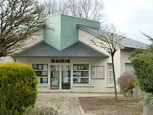 Rathaus von Lourenties | ||

Geografie
Lourenties liegt am Plateau von Ger an der Grenze zur Region Midi-Pyrénées am Fuß der Pyrenäen. Lourenties wird im Norden durch den Gabas begrenzt. Umgeben wird Lourenties von den Nachbargemeinden Arrien im Norden, Eslourenties-Daban im Nordosten, Gardères im Osten, Luquet im Südosten, Espoey im Süden, Limendous im Westen und Südwesten sowie Espéchède im Westen und Nordwesten.
Bevölkerungsentwicklung
| 1962 | 1968 | 1975 | 1982 | 1990 | 1999 | 2006 | 2012 | |
|---|---|---|---|---|---|---|---|---|
| 187 | 168 | 188 | 175 | 272 | 277 | 328 | 351 | |
| Quelle: Cassini und INSEE | ||||||||
Sehenswürdigkeiten
- Kirche Saint-Jean-Baptiste aus dem 19. Jahrhundert
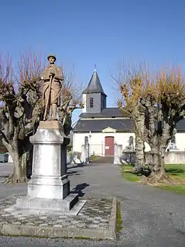
Kirche Saint-Jean-Baptiste
This article is issued from Wikipedia. The text is licensed under Creative Commons - Attribution - Sharealike. The authors of the article are listed here. Additional terms may apply for the media files, click on images to show image meta data.