Taingy
| Taingy | ||
|---|---|---|

|
| |
| Gemeinde | Les Hauts de Forterre | |
| Region | Bourgogne-Franche-Comté | |
| Département | Yonne | |
| Arrondissement | Auxerre | |
| Koordinaten | 47° 37′ N, 3° 24′ O | |
| Postleitzahl | 89560 | |
| Ehemaliger INSEE-Code | 89405 | |
| Eingemeindung | 1. Januar 2017 | |
| Status | Commune déléguée | |
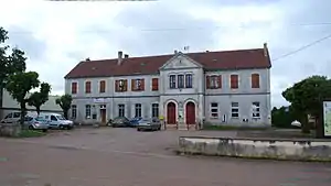
 Rathaus (Mairie) von Taingy | ||
Taingy ist eine Commune déléguée in der französischen Gemeinde Les Hauts de Forterre mit 261 Einwohnern (Stand: 1. Januar 2019) im Département Yonne in der Region Bourgogne-Franche-Comté (bis 2015: Burgund).
Geografie
Taingy liegt im Süden der Landschaft Puisaye, etwa 21 Kilometer südsüdwestlich von Auxerre.
Geschichte
Zum 1. Januar 2017 wurde aus den Kommunen Fontenailles, Molesmes und Taingy die Commune nouvelle Les Hauts de Forterre gebildet. Die Gemeinde gehörte zum Arrondissement Auxerre und zum Kanton Vincelles (bis 2015 Kanton Courson-les-Carrières).
Bevölkerungsentwicklung
| Jahr | 1962 | 1968 | 1975 | 1982 | 1990 | 1999 | 2006 | 2013 |
| Einwohner | 516 | 442 | 367 | 335 | 262 | 254 | 293 | 310 |
| Quelle: Cassini und INSEE | ||||||||
Sehenswürdigkeiten
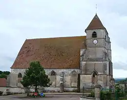
- Kirche Saint-Martin, seit 1926 Monument historique
- Steinbruch von Aubigny

Kirche Saint-Martin
Weblinks
Commons: Taingy – Sammlung von Bildern, Videos und Audiodateien
This article is issued from Wikipedia. The text is licensed under Creative Commons - Attribution - Sharealike. The authors of the article are listed here. Additional terms may apply for the media files, click on images to show image meta data.
