Le Mesnil-Simon (Eure-et-Loir)
Le Mesnil-Simon ist eine französische Gemeinde mit 568 Einwohnern (Stand: 1. Januar 2019) im Département Eure-et-Loir in der Region Centre-Val de Loire; sie gehört zum Arrondissement Dreux und zum Kanton Anet.
| Le Mesnil-Simon | ||
|---|---|---|
.svg.png.webp)
|
| |
| Staat | Frankreich | |
| Region | Centre-Val de Loire | |
| Département (Nr.) | Eure-et-Loir (28) | |
| Arrondissement | Dreux | |
| Kanton | Anet | |
| Gemeindeverband | Agglo du Pays de Dreux | |
| Koordinaten | 48° 54′ N, 1° 32′ O | |
| Höhe | 108–167 m | |
| Fläche | 9,23 km² | |
| Einwohner | 568 (1. Januar 2019) | |
| Bevölkerungsdichte | 62 Einw./km² | |
| Postleitzahl | 28260 | |
| INSEE-Code | 28247 | |
| Website | https://lms28.pagesperso-orange.fr/ | |
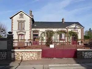 Rathaus (Mairie) und Schule von Le Mesnil-Simon | ||

Geographie
Le Mesnil-Simon liegt etwa 50 Kilometer nördlich von Chartres und etwa 55 Kilometer westnordwestlich von Paris. Umgeben wird Le Mesnil-Simon von den Nachbargemeinden Gilles im Norden und Nordwesten, Mondreville im Osten und Nordosten, Tilly im Osten und Südosten, Saint-Ouen-Marchefroy im Süden, Oulins im Südwesten sowie La Chaussée-d’Ivry im Westen.
Bevölkerungsentwicklung
| Jahr | 1962 | 1968 | 1975 | 1982 | 1990 | 1999 | 2006 | 2013 | |
|---|---|---|---|---|---|---|---|---|---|
| Einwohner | 231 | 185 | 239 | 251 | 337 | 414 | 482 | 591 | |
| Quelle: Cassini und INSEE | |||||||||
Sehenswürdigkeiten
- Kirche Saint-Nicolas aus dem 13. Jahrhundert, seit 1971 Monument historique
- Mausoleum der Familie Malebranche, insbesondere für Nicolas Malebranche, 1733 erbaut, seit 1963 Monument historique
 Kirche Saint-Nicolas
 Mausoleum
Weblinks
Commons: Le Mesnil-Simon – Sammlung von Bildern, Videos und Audiodateien
This article is issued from Wikipedia. The text is licensed under Creative Commons - Attribution - Sharealike. The authors of the article are listed here. Additional terms may apply for the media files, click on images to show image meta data.