Kanton Anet
Der Kanton Anet ist ein französischer Wahlkreis im Arrondissement Dreux, im Département Eure-et-Loir und in der Region Centre-Val de Loire; sein Hauptort ist Anet.
| Kanton Anet | |
|---|---|
| Region | Centre-Val de Loire |
| Département | Eure-et-Loir |
| Arrondissement | Dreux |
| Hauptort | Anet |
| Einwohner | 24.914 (1. Jan. 2019) |
| Bevölkerungsdichte | 85 Einw./km² |
| Fläche | 292,48 km² |
| Gemeinden | 25 |
| INSEE-Code | 2801 |
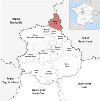 Lage des Kantons Anet im Département Eure-et-Loir | |
Gemeinden
Der Kanton besteht aus 25 Gemeinden mit insgesamt 24.914 Einwohnern (Stand: 1. Januar 2019) auf einer Gesamtfläche von 292,48 km²:
| Gemeinde | Einwohner 1. Januar 2019 |
Fläche km² |
Dichte Einw./km² |
Code INSEE |
Postleitzahl |
|---|---|---|---|---|---|
| Abondant | 2.390 | 35,08 | 68 | 28001 | 28410 |
| Anet | 2.697 | 7,91 | 341 | 28007 | 28260 |
| Berchères-sur-Vesgre | 847 | 12,23 | 69 | 28036 | 28260 |
| Boncourt | 267 | 3,75 | 71 | 28050 | 28260 |
| Boutigny-Prouais | 1.699 | 32,95 | 52 | 28056 | 28410 |
| Broué | 899 | 12,18 | 74 | 28062 | 28410 |
| Bû | 2.007 | 23,09 | 87 | 28064 | 28410 |
| Cherisy | 1.841 | 12,39 | 149 | 28098 | 28500 |
| Germainville | 313 | 8,80 | 36 | 28178 | 28500 |
| Gilles | 501 | 7,33 | 68 | 28180 | 28260 |
| Goussainville | 1.302 | 13,30 | 98 | 28185 | 28410 |
| Guainville | 656 | 14,34 | 46 | 28187 | 28260 |
| Havelu | 135 | 3,73 | 36 | 28193 | 28410 |
| La Chapelle-Forainvilliers | 194 | 5,44 | 36 | 28076 | 28500 |
| La Chaussée-d’Ivry | 1.226 | 8,44 | 145 | 28096 | 28260 |
| Le Mesnil-Simon | 568 | 9,23 | 62 | 28247 | 28260 |
| Marchezais | 369 | 2,23 | 165 | 28235 | 28410 |
| Montreuil | 508 | 6,31 | 81 | 28267 | 28500 |
| Oulins | 1.197 | 10,24 | 117 | 28293 | 28260 |
| Rouvres | 838 | 16,44 | 51 | 28321 | 28260 |
| Saint-Lubin-de-la-Haye | 933 | 14,35 | 65 | 28347 | 28410 |
| Saint-Ouen-Marchefroy | 296 | 9,42 | 31 | 28355 | 28260 |
| Saussay | 1.101 | 4,69 | 235 | 28371 | 28260 |
| Serville | 369 | 5,62 | 66 | 28375 | 28410 |
| Sorel-Moussel | 1.761 | 12,99 | 136 | 28377 | 28260 |
| Kanton Anet | 24.914 | 292,48 | 85 | 2801 | – |
Bis zur landesweiten Neuordnung der französischen Kantone im März 2015 gehörten zum Kanton Anet die 20 Gemeinden Abondant, Anet, Berchères-sur-Vesgre, Boncourt, Broué, Bû, Gilles, Goussainville, Guainville, Havelu, La Chaussée-d’Ivry, Le Mesnil-Simon, Marchezais, Oulins, Rouvres, Saint-Lubin-de-la-Haye, Saint-Ouen-Marchefroy, Saussay, Serville und Sorel-Moussel. Sein Zuschnitt entsprach einer Fläche von 223,71 km2.
This article is issued from Wikipedia. The text is licensed under Creative Commons - Attribution - Sharealike. The authors of the article are listed here. Additional terms may apply for the media files, click on images to show image meta data.