Laroquebrou
| Laroquebrou Laròcabrau | ||
|---|---|---|

|
| |
| Staat | Frankreich | |
| Region | Auvergne-Rhône-Alpes | |
| Département (Nr.) | Cantal (15) | |
| Arrondissement | Aurillac | |
| Kanton | Saint-Paul-des-Landes | |
| Gemeindeverband | Châtaigneraie Cantalienne | |
| Koordinaten | 44° 58′ N, 2° 12′ O | |
| Höhe | 429–693 m | |
| Fläche | 17,15 km² | |
| Einwohner | 829 (1. Januar 2019) | |
| Bevölkerungsdichte | 48 Einw./km² | |
| Postleitzahl | 15150 | |
| INSEE-Code | 15094 | |
| Website | https://www.laroquebrou.fr/ | |
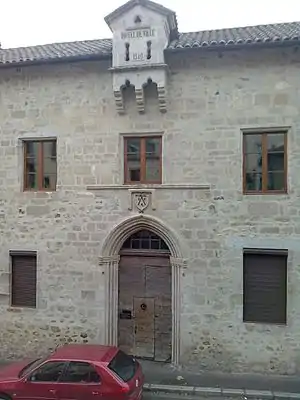 Rathaus (Mairie) von Laroquebrou | ||

Laroquebrou (okzitanisch: Laròcabrau) ist eine französische Gemeinde mit 829 Einwohnern (Stand: 1. Januar 2019) im Département Cantal in der Region Auvergne-Rhône-Alpes. Die Gemeinde gehört zum Arrondissement Aurillac und zum Kanton Saint-Paul-des-Landes (bis 2015: Kanton Laroquebrou). Die Einwohner werden Roquais genannt.
Geografie
Laroquebrou liegt etwa zwanzig Kilometer westnordwestlich von Aurillac. Umgeben wird Laroquebrou von den Nachbargemeinden Saint-Santin-Cantalès im Norden und Nordosten, Nieudan im Osten, Saint-Étienne-Cantalès im Südosten, Saint-Gérons im Süden, Siran im Westen und Südwesten sowie Montvert im Westen und Nordwesten.
Bevölkerungsentwicklung
| Jahr | 1962 | 1968 | 1975 | 1982 | 1990 | 1999 | 2006 | 2013 |
| Einwohner | 1.237 | 1.193 | 1.014 | 1.023 | 1.048 | 1.080 | 1.001 | 831 |
| Quellen: Cassini und INSEE | ||||||||
Sehenswürdigkeiten
- Kirche Saint-Martin, Monument historique
- Schloss Laroque
- Schloss Messac, Monument historique
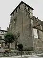 Kirche Saint-Martin
.jpg.webp) Schloss Laroque
Schloss Laroque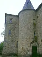 Schloss Messac
Persönlichkeiten
- Jacques Faizant (1918–2006), Illustrator
- René Cance (1895–1982), Politiker (PCF), Bürgermeister von Le Havre (1956–1959 und 1965–1971)
This article is issued from Wikipedia. The text is licensed under Creative Commons - Attribution - Sharealike. The authors of the article are listed here. Additional terms may apply for the media files, click on images to show image meta data.