Golancourt
Golancourt ist eine französische Gemeinde mit 398 Einwohnern (Stand: 1. Januar 2019) im Département Oise in der Region Hauts-de-France (vor 2016 Picardie). Sie gehört zum Kanton Noyon (bis 2015 Guiscard) und zum Gemeindeverband Pays Noyonnais.
| Golancourt | ||
|---|---|---|

|
| |
| Staat | Frankreich | |
| Region | Hauts-de-France | |
| Département (Nr.) | Oise (60) | |
| Arrondissement | Compiègne | |
| Kanton | Noyon | |
| Gemeindeverband | Pays Noyonnais | |
| Koordinaten | 49° 42′ N, 3° 4′ O | |
| Höhe | 61–92 m | |
| Fläche | 4,13 km² | |
| Einwohner | 398 (1. Januar 2019) | |
| Bevölkerungsdichte | 96 Einw./km² | |
| Postleitzahl | 60640 | |
| INSEE-Code | 60278 | |
| Website | http://www.golancourt.fr.sitew.com/ | |
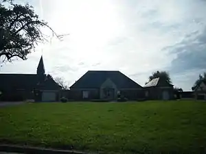 Blick auf Golancourt | ||

Geografie
Golancourt liegt im Pays Noyonnais etwa 50 Kilometer nordöstlich von Compiègne. Umgeben wird Golancourt von den Nachbargemeinden Muille-Villette im Norden, Brouchy im Osten und Nordosten, Berlancourt im Südosten, Le Plessis-Patte-d’Oie im Süden, Flavy-le-Meldeux im Südwesten sowie Esmery-Hallon im Westen und Nordwesten.
Bevölkerungsentwicklung
| Jahr | 1962 | 1968 | 1975 | 1982 | 1990 | 1999 | 2006 | 2013 |
|---|---|---|---|---|---|---|---|---|
| Einwohner | 300 | 317 | 332 | 364 | 418 | 404 | 406 | 371 |
| Quelle: Cassini und INSEE | ||||||||
Sehenswürdigkeiten
- Kirche Saint-Rémi (siehe auch: Liste der Monuments historiques in Golancourt)
This article is issued from Wikipedia. The text is licensed under Creative Commons - Attribution - Sharealike. The authors of the article are listed here. Additional terms may apply for the media files, click on images to show image meta data.