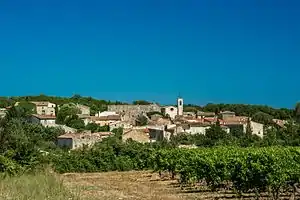
Collorgues
Collorgues ist eine französische Gemeinde mit 634 Einwohnern (Stand: 1. Januar 2019) im Département Gard in der Region Okzitanien. Mus gehört zum Arrondissement Nîmes und zum Kanton Uzès (bis 2015: Kanton Saint-Chaptes). Die Einwohner werden Collorguois genannt.
| Collorgues | ||
|---|---|---|
.svg.png.webp)
|
| |
| Staat | Frankreich | |
| Region | Okzitanien | |
| Département (Nr.) | Gard (30) | |
| Arrondissement | Nîmes | |
| Kanton | Uzès | |
| Gemeindeverband | Pays d’Uzès | |
| Koordinaten | 44° 0′ N, 4° 18′ O | |
| Höhe | 109–216 m | |
| Fläche | 9,29 km² | |
| Einwohner | 634 (1. Januar 2019) | |
| Bevölkerungsdichte | 68 Einw./km² | |
| Postleitzahl | 30190 | |
| INSEE-Code | 30086 | |
 Collorgues | ||

Geografie
Collorgues liegt 20 Kilometer nordnordwestlich von Nîmes und etwa 20 Kilometer südöstlich von Alès. Umgeben wird Collorgues von den Nachbargemeinden Baron und Foissac im Norden, Serviers-et-Labaume im Nordosten, Aubussargues im Osten, Garrigues-Sainte-Eulalie im Süden und Südosten, Saint-Dézéry im Südwesten, Castelnau-Valence im Westen sowie Saint-Maurice-de-Cazevieille im Nordwesten.
Bevölkerungsentwicklung
| Jahr | 1962 | 1968 | 1975 | 1982 | 1990 | 1999 | 2006 | 2017 |
|---|---|---|---|---|---|---|---|---|
| Einwohner | 204 | 196 | 196 | 210 | 309 | 359 | 490 | 608 |
| Quellen: Cassini und INSEE | ||||||||
Sehenswürdigkeiten
- Statuenmenhire, seit 1927 Monument historique
- evangelische Kirche
This article is issued from Wikipedia. The text is licensed under Creative Commons - Attribution - Sharealike. The authors of the article are listed here. Additional terms may apply for the media files, click on images to show image meta data.