Camboulazet
Camboulazet (okzitanisch Cambolaset) ist eine französische Gemeinde des Départements Aveyron mit 388 Einwohnern (Stand 1. Januar 2019) in der Region Okzitanien (vor 2016 Midi-Pyrénées). Sie ist dem Kanton Ceor-Ségala (bis 2015 Baraqueville-Sauveterre) und dem Arrondissement Villefranche-de-Rouergue (bis 2017 Rodez) zugeteilt. Die Einwohner werden Camboulazetois genannt.
| Camboulazet Cambolaset | ||
|---|---|---|
| ||
| Staat | Frankreich | |
| Region | Okzitanien | |
| Département (Nr.) | Aveyron (12) | |
| Arrondissement | Villefranche-de-Rouergue | |
| Kanton | Ceor-Ségala | |
| Gemeindeverband | Pays Ségali | |
| Koordinaten | 44° 14′ N, 2° 27′ O | |
| Höhe | 379–746 m | |
| Fläche | 14,42 km² | |
| Einwohner | 388 (1. Januar 2019) | |
| Bevölkerungsdichte | 27 Einw./km² | |
| Postleitzahl | 12160 | |
| INSEE-Code | 12045 | |
| Website | http://www.camboulazet12.fr/index.aspx | |
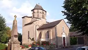 Kirche Saint-Amans | ||

Geografie
Camboulazet liegt etwa 18 Kilometer südsüdwestlich von Rodez im Zentralmassiv. Umgeben wird Camboulazet von den Nachbargemeinden Baraqueville im Norden, Manhac im Osten und Nordosten, Sainte-Juliette-sur-Viaur im Osten, Centrès im Süden, Camjac im Südwesten sowie Quins im Westen.
Bevölkerungsentwicklung
| Jahr | 1962 | 1968 | 1975 | 1982 | 1990 | 1999 | 2006 | 2013 |
|---|---|---|---|---|---|---|---|---|
| Einwohner | 426 | 397 | 344 | 329 | 295 | 314 | 342 | 425 |
| Quelle: Cassini und INSEE | ||||||||
Sehenswürdigkeiten
- gotische Kirche Saint-Amans von 1540
Weblinks
Commons: Camboulazet – Sammlung von Bildern, Videos und Audiodateien
This article is issued from Wikipedia. The text is licensed under Creative Commons - Attribution - Sharealike. The authors of the article are listed here. Additional terms may apply for the media files, click on images to show image meta data.