Villers-Saint-Barthélemy
Villers-Saint-Barthélemy ist eine französische Gemeinde mit 466 Einwohnern (Stand 1. Januar 2019) im Département Oise in der Region Hauts-de-France. Die Gemeinde liegt im Arrondissement Beauvais und ist Teil der Communauté de communes du Pays de Bray und des Beauvais-2.
| Villers-Saint-Barthélemy | ||
|---|---|---|
| ||
| Staat | Frankreich | |
| Region | Hauts-de-France | |
| Département (Nr.) | Oise (60) | |
| Arrondissement | Beauvais | |
| Kanton | Beauvais-2 | |
| Gemeindeverband | Pays de Bray | |
| Koordinaten | 49° 24′ N, 1° 57′ O | |
| Höhe | 79–185 m | |
| Fläche | 9,92 km² | |
| Einwohner | 466 (1. Januar 2019) | |
| Bevölkerungsdichte | 47 Einw./km² | |
| Postleitzahl | 60650 | |
| INSEE-Code | 60681 | |
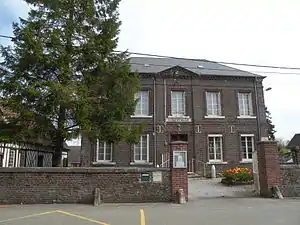
 Mairie Villers-Saint-Barthélemy | ||
Geographie
Die Gemeinde liegt rund 15 Kilometer westlich von Beauvais. Sie wird im Osten vom Bach Ruisseau du Moulinet begrenzt, der in den Avelon mündet. Im Norden berührt die Route nationale 31 (Europastraße 46) das Gemeindegebiet. Die Gemeinde umfasst die Weiler Marconville, Le Ply, Vaux und Le Grand Bailly.
Geschichte
Die Gemeinde wurde im Jahr 1037 dem Kapitel von Saint-Barthélemy in Beauvais geschenkt.
Einwohner
| 1962 | 1968 | 1975 | 1982 | 1990 | 1999 | 2006 | 2011 | 2016 |
|---|---|---|---|---|---|---|---|---|
| 288 | 262 | 299 | 384 | 467 | 485 | 467 | 492 | 493 |
Verwaltung

Kirche Saint-Martin
Bürgermeister (maire) ist seit 2008 Claude Maillard.
Sehenswürdigkeiten
- Kirche Saint-Martin aus dem 16. Jahrhundert[1]
Weblinks
Commons: Villers-Saint-Barthélemy – Sammlung von Bildern, Videos und Audiodateien
- Monuments historiques (Objekte) in Villers-Saint-Barthélemy in der Base Palissy des französischen Kultusministeriums
This article is issued from Wikipedia. The text is licensed under Creative Commons - Attribution - Sharealike. The authors of the article are listed here. Additional terms may apply for the media files, click on images to show image meta data.
