Lhéraule
Lhéraule ist eine französische Gemeinde mit 196 Einwohnern (Stand 1. Januar 2019) im Département Oise in der Region Hauts-de-France. Die Gemeinde liegt im Arrondissement Beauvais und ist Teil der Communauté de communes du Pays de Bray und des Kantons Grandvilliers.
| Lhéraule | ||
|---|---|---|
| ||
| Staat | Frankreich | |
| Region | Hauts-de-France | |
| Département (Nr.) | Oise (60) | |
| Arrondissement | Beauvais | |
| Kanton | Grandvilliers | |
| Gemeindeverband | Pays de Bray | |
| Koordinaten | 49° 29′ N, 1° 56′ O | |
| Höhe | 118–218 m | |
| Fläche | 2,84 km² | |
| Einwohner | 196 (1. Januar 2019) | |
| Bevölkerungsdichte | 69 Einw./km² | |
| Postleitzahl | 60650 | |
| INSEE-Code | 60359 | |
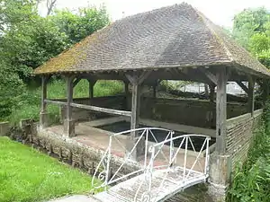
 Lavoir Lhéraule | ||
Geographie
Die Gemeinde liegt rund zwölf Kilometer südöstlich von Songeons und zwölf Kilometer nordwestlich von Beauvais im Einzugsbereich des Flusses Thérain.
Einwohner
| 1962 | 1968 | 1975 | 1982 | 1990 | 1999 | 2006 | 2011 |
|---|---|---|---|---|---|---|---|
| 70 | 93 | 103 | 122 | 135 | 142 | 149 | 199 |
Verwaltung
Bürgermeister (maire) ist seit 2006 Gérard Plée.
Sehenswürdigkeiten
- Kirche Saint-Claude[1] (siehe auch: Liste der Monuments historiques in Lhéraule)

Kirche Saint-Claude
This article is issued from Wikipedia. The text is licensed under Creative Commons - Attribution - Sharealike. The authors of the article are listed here. Additional terms may apply for the media files, click on images to show image meta data.
