Urbanya
Urbanya ist eine französische Gemeinde mit 50 Einwohnern (Stand 1. Januar 2019) im Département Pyrénées-Orientales in der Region Okzitanien.
| Urbanya | ||
|---|---|---|
| ||
| Staat | Frankreich | |
| Region | Okzitanien | |
| Département (Nr.) | Pyrénées-Orientales (66) | |
| Arrondissement | Prades | |
| Kanton | Les Pyrénées catalanes | |
| Gemeindeverband | Conflent-Canigó | |
| Koordinaten | 42° 38′ N, 2° 18′ O | |
| Höhe | 720–1765 m | |
| Fläche | 13,94 km² | |
| Einwohner | 50 (1. Januar 2019) | |
| Bevölkerungsdichte | 4 Einw./km² | |
| Postleitzahl | 66500 | |
| INSEE-Code | 66219 | |
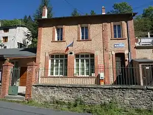 Rathaus (Mairie) | ||

Geografie
Die Nachbargemeinden sind Ria-Sirach, Nohèdes, Conat und Mosset. Urbanya liegt im Gebirgssystem Massif du Madres.
Geschichte
Urkundlich erstmals erwähnt wurde Urbanya 1186.
Urbanya wurde 1973 mit Ria-Sirach zusammengelegt und 1983 wieder verselbständigt.
This article is issued from Wikipedia. The text is licensed under Creative Commons - Attribution - Sharealike. The authors of the article are listed here. Additional terms may apply for the media files, click on images to show image meta data.