Prunet-et-Belpuig
Prunet-et-Belpuig ist eine französische Gemeinde mit 48 Einwohnern (Stand 1. Januar 2019) im Département Pyrénées-Orientales in der Region Okzitanien. Sie gehört zum Arrondissement Prades und zum Kanton Le Canigou.
| Prunet-et-Belpuig | ||
|---|---|---|
| ||
| Staat | Frankreich | |
| Region | Okzitanien | |
| Département (Nr.) | Pyrénées-Orientales (66) | |
| Arrondissement | Prades | |
| Kanton | Le Canigou | |
| Gemeindeverband | Roussillon-Conflent | |
| Koordinaten | 42° 34′ N, 2° 33′ O | |
| Höhe | 353–863 m | |
| Fläche | 21,81 km² | |
| Einwohner | 48 (1. Januar 2019) | |
| Bevölkerungsdichte | 2 Einw./km² | |
| Postleitzahl | 66130 | |
| INSEE-Code | 66153 | |
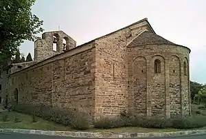 Chapelle de la Trinité | ||

Nachbargemeinden
Nachbargemeinden von Prunet-et-Belpuig sind Caixas im Norden, Calmeilles im Osten, Saint-Marsal im Süden, La Bastide im Südwesten und Boule-d’Amont im Westen.
Bevölkerungsentwicklung
| Jahr | 1962 | 1968 | 1975 | 1982 | 1990 | 1999 | 2013 |
| Einwohner | 63 | 55 | 36 | 37 | 52 | 68 | 53 |
Sehenswürdigkeiten
- Chapelle de la Trinité, romanisch
- Burg Belpuig (14. Jahrhundert)
- Kirche Saint-Étienne in Prunet
This article is issued from Wikipedia. The text is licensed under Creative Commons - Attribution - Sharealike. The authors of the article are listed here. Additional terms may apply for the media files, click on images to show image meta data.