Bouleternère
Bouleternère ist eine französische Gemeinde mit 949 Einwohnern (Stand 1. Januar 2019) im Département Pyrénées-Orientales in der Region Okzitanien. Sie gehört zum Arrondissement Prades und zum Kanton Le Canigou.
| Bouleternère | ||
|---|---|---|

|
| |
| Staat | Frankreich | |
| Region | Okzitanien | |
| Département (Nr.) | Pyrénées-Orientales (66) | |
| Arrondissement | Prades | |
| Kanton | Le Canigou | |
| Gemeindeverband | Roussillon-Conflent | |
| Koordinaten | 42° 39′ N, 2° 35′ O | |
| Höhe | 160–612 m | |
| Fläche | 10,78 km² | |
| Einwohner | 949 (1. Januar 2019) | |
| Bevölkerungsdichte | 88 Einw./km² | |
| Postleitzahl | 66130 | |
| INSEE-Code | 66023 | |
| Website | https://www.bouleternere.fr/ | |
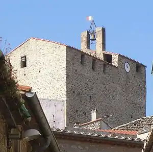 Kirche Saint-Sulpice | ||

Geographie
Nachbargemeinden von Bouleternère sind Ille-sur-Têt im Nordosten, Saint-Michel-de-Llotes im Osten, Casefabre im Südosten, Boule-d’Amont im Süden und Rodès im Nordwesten.
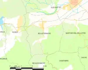
Karte von Bouleternère
Bevölkerungsentwicklung
| Jahr | 1962 | 1968 | 1975 | 1982 | 1990 | 1999 | 2013 |
| Einwohner | 818 | 885 | 739 | 728 | 625 | 643 | 906 |
Sehenswürdigkeiten
- Stadtmauer mit zwei Türmen und drei Toren
- Kapelle Sainte-Anne
- Kirche Saint-Nazaire in Barbadell
- Ehemalige Kirche Saint-Sulpice (11. Jahrhundert)
- Neue Kirche Saint-Sulpice (1659)
- Burg Belpuig (14. Jahrhundert)
- Kirche Saint-Étienne in Prunet
 Turm der Stadtmauer
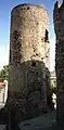 Turm der Stadtmauer
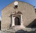 Portal der neuen Kirche Saint-Sulpice
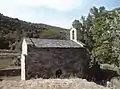 Kirche Saint-Nazaire in Barbadell
This article is issued from Wikipedia. The text is licensed under Creative Commons - Attribution - Sharealike. The authors of the article are listed here. Additional terms may apply for the media files, click on images to show image meta data.