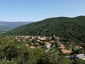
Taurinya
| Taurinya | ||
|---|---|---|

|
| |
| Staat | Frankreich | |
| Region | Okzitanien | |
| Département (Nr.) | Pyrénées-Orientales (66) | |
| Arrondissement | Prades | |
| Kanton | Le Canigou | |
| Gemeindeverband | Conflent-Canigó | |
| Koordinaten | 42° 35′ N, 2° 26′ O | |
| Höhe | 478–2784 m | |
| Fläche | 13,68 km² | |
| Einwohner | 332 (1. Januar 2019) | |
| Bevölkerungsdichte | 24 Einw./km² | |
| Postleitzahl | 66500 | |
| INSEE-Code | 66204 | |
| Website | http://www.taurinya.fr/ | |
 Taurinya | ||

Taurinya ist eine französische Gemeinde mit 332 Einwohnern (Stand 1. Januar 2019) im Département Pyrénées-Orientales in der Region Okzitanien. Sie gehört zum Arrondissement Prades und zum Kanton Le Canigou.
Nachbargemeinden
Nachbargemeinden von Taurinya sind Prades im Norden, Clara-Villerach im Nordosten, Estoher im Osten, Valmanya im Südosten, Casteil im Süden, Vernet-les-Bains im Südwesten, Fillols im Westen sowie Codalet und Ria-Sirach im Nordwesten.
Bevölkerungsentwicklung
| Jahr | 1962 | 1968 | 1975 | 1982 | 1990 | 1999 | 2013 |
| Einwohner | 326 | 242 | 225 | 215 | 248 | 307 | 328 |
Sehenswürdigkeiten
- Kirche Saint-Fructueux in Taurinya
- Kirche Saint-Valentin in Corts

Kirche Saint-Fructueux
This article is issued from Wikipedia. The text is licensed under Creative Commons - Attribution - Sharealike. The authors of the article are listed here. Additional terms may apply for the media files, click on images to show image meta data.