Saint-Paul-et-Valmalle
Saint-Paul-et-Valmalle ist eine französische Gemeinde mit 1248 Einwohnern (Stand 1. Januar 2019) im Département Hérault in der Region Okzitanien. Sie gehört zum Kanton Gignac im Arrondissement Lodève.
| Saint-Paul-et-Valmalle | ||
|---|---|---|
.svg.png.webp)
|
| |
| Staat | Frankreich | |
| Region | Okzitanien | |
| Département (Nr.) | Hérault (34) | |
| Arrondissement | Lodève | |
| Kanton | Gignac | |
| Gemeindeverband | Vallée de l’Hérault | |
| Koordinaten | 43° 38′ N, 3° 41′ O | |
| Höhe | 110–319 m | |
| Fläche | 12,84 km² | |
| Einwohner | 1.248 (1. Januar 2019) | |
| Bevölkerungsdichte | 97 Einw./km² | |
| Postleitzahl | 34570 | |
| INSEE-Code | 34282 | |
| Website | https://www.stpauletvalmalle.fr/ | |
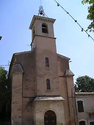 Kirche der Bekehrung von St. Paul | ||

Geographie
Im Gemeindegebiet von Saint-Paul-et-Valmalle entspringt der Fluss Mosson unter dem Namen Ruisseau des Mages.
Die Autoroute A750 verläuft am nördlichen Ortsrand.
Bevölkerungsentwicklung
| Jahr | 1962 | 1968 | 1975 | 1982 | 1990 | 1999 | 2010 | 2017 |
| Einwohner | 267 | 272 | 315 | 385 | 593 | 754 | 1020 | 1124 |
| Quellen: Cassini und INSEE | ||||||||
This article is issued from Wikipedia. The text is licensed under Creative Commons - Attribution - Sharealike. The authors of the article are listed here. Additional terms may apply for the media files, click on images to show image meta data.