Saint-André-le-Gaz
Saint-André-le-Gaz ist eine französische Gemeinde mit 2.760 Einwohnern (Stand: 1. Januar 2019) im Département Isère in der Region Auvergne-Rhône-Alpes. Sie gehört administrativ zum Arrondissement La Tour-du-Pin und ist Teil des Kantons La Tour-du-Pin. Die Einwohner werden Saint-Andréens genannt.
| Saint-André-le-Gaz | ||
|---|---|---|
| ||
| Staat | Frankreich | |
| Region | Auvergne-Rhône-Alpes | |
| Département (Nr.) | Isère (38) | |
| Arrondissement | La Tour-du-Pin | |
| Kanton | La Tour-du-Pin | |
| Gemeindeverband | Les Vals du Dauphiné | |
| Koordinaten | 45° 33′ N, 5° 32′ O | |
| Höhe | 356–488 m | |
| Fläche | 8,98 km² | |
| Einwohner | 2.760 (1. Januar 2019) | |
| Bevölkerungsdichte | 307 Einw./km² | |
| Postleitzahl | 38490 | |
| INSEE-Code | 38357 | |
| Website | https://saintandrelegaz.fr/ | |
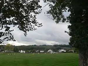 Blick auf Saint-André-le-Gaz | ||

Geographie
Saint-André-le-Gaz wird im Norden und Osten vom Fluss Bourbre begrenzt. Saint-André-le-Gaz wird umgeben von den Nachbargemeinden La Bâtie-Montgascon im Norden, Fitilieu im Osten, Saint-Ondras im Südosten, Le Passage im Süden und Südwesten sowie Saint-Didier-de-la-Tour im Nordwesten.
Die Autoroute A43 führt an der nördlichen Gemeindegrenze entlang.
Bevölkerungsentwicklung
| Jahr | 1962 | 1968 | 1975 | 1982 | 1990 | 1999 | 2006 | 2012 |
| Einwohner | 1.311 | 1.406 | 1.526 | 1.641 | 1.903 | 1.961 | 2.291 | 2.605 |
| Quellen: Cassini und INSEE | ||||||||
Sehenswürdigkeiten
- Kirche Saint-André mit Glockenturm
- Schloss Verel
This article is issued from Wikipedia. The text is licensed under Creative Commons - Attribution - Sharealike. The authors of the article are listed here. Additional terms may apply for the media files, click on images to show image meta data.