Panossas
Panossas ist eine französische Gemeinde mit 660 Einwohnern (Stand: 1. Januar 2019) im Département Isère in der Region Auvergne-Rhône-Alpes. Panossas liegt im Arrondissement La Tour-du-Pin und im Kanton Charvieu-Chavagneux (bis 2015: Kanton Crémieu). Die Einwohner werden Panossiens genannt.
| Panossas | ||
|---|---|---|
| ||
| Staat | Frankreich | |
| Region | Auvergne-Rhône-Alpes | |
| Département (Nr.) | Isère (38) | |
| Arrondissement | La Tour-du-Pin | |
| Kanton | Charvieu-Chavagneux | |
| Gemeindeverband | Les Balcons du Dauphiné | |
| Koordinaten | 45° 41′ N, 5° 12′ O | |
| Höhe | 223–390 m | |
| Fläche | 8,05 km² | |
| Einwohner | 660 (1. Januar 2019) | |
| Bevölkerungsdichte | 82 Einw./km² | |
| Postleitzahl | 38460 | |
| INSEE-Code | 38294 | |
| Website | http://www.panossas.fr/ | |
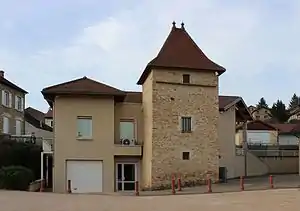 Rathaus von Panossas | ||

Geographie
Panossas liegt etwa 31 Kilometer ostsüdöstlich von Lyon. Umgeben wird Panossas von den Nachbargemeinden Chozeau im Norden, Veyssilieu im Osten, Frontonas im Süden sowie Chamagnieu im Westen.
Bevölkerungsentwicklung
| Jahr | 1962 | 1968 | 1975 | 1982 | 1990 | 1999 | 2006 | 2012 |
|---|---|---|---|---|---|---|---|---|
| Einwohner | 176 | 166 | 187 | 227 | 346 | 498 | 555 | 654 |
| Quellen: Cassini und INSEE | ||||||||
Sehenswürdigkeiten
- Kirche Saint-Martin
- Schloss Antouillet
- Wehrhof Bonrepos, Ende des 16. Jahrhunderts erbaut
- Ruinen der gallorömischen Siedlung in Les Bussières
- Waschhaus
- Weinpresse am See Marsa
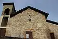 Kirche Saint-Martin
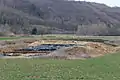 Grabungsstelle der Ruinen von Les Bussières
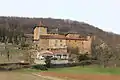 Schloss Antouillet
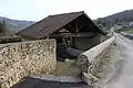 Waschhaus
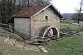 Weinpresse
This article is issued from Wikipedia. The text is licensed under Creative Commons - Attribution - Sharealike. The authors of the article are listed here. Additional terms may apply for the media files, click on images to show image meta data.