Poillé-sur-Vègre
Poillé-sur-Vègre ist eine französische Gemeinde mit 612 Einwohnern (Stand: 1. Januar 2019) im Département Sarthe in der Region Pays de la Loire. Die Gemeinde gehört zum Arrondissement La Flèche und zum Kanton Loué. Die Einwohner werden Poilléens genannt.
| Poillé-sur-Vègre | ||
|---|---|---|
| ||
| Staat | Frankreich | |
| Region | Pays de la Loire | |
| Département (Nr.) | Sarthe (72) | |
| Arrondissement | La Flèche | |
| Kanton | Loué | |
| Gemeindeverband | Loué-Brûlon-Noyen | |
| Koordinaten | 47° 55′ N, 0° 16′ W | |
| Höhe | 38–96 m | |
| Fläche | 17,57 km² | |
| Einwohner | 612 (1. Januar 2019) | |
| Bevölkerungsdichte | 35 Einw./km² | |
| Postleitzahl | 72350 | |
| INSEE-Code | 72239 | |
| Website | http://www.poille-sur-vegre.com/ | |
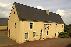 Rathaus (Mairie) von Poillé-sur-Vègre | ||

Geografie
Poillé-sur-Vègre liegt etwa 32 Kilometer westsüdwestlich von Le Mans am Vègre. Umgeben wird Poillé-sur-Vègre von den Nachbargemeinden Avessé im Norden, Chevillé im Nordosten, Fontenay-sur-Vègre im Osten, Asnières-sur-Vègre im Süden und Südosten, Auvers-le-Hamon im Westen und Südwesten sowie Épineux-le-Seguin im Nordwesten.
Bevölkerungsentwicklung
| 1962 | 1968 | 1975 | 1982 | 1990 | 1999 | 2006 | 2013 | |
|---|---|---|---|---|---|---|---|---|
| 633 | 545 | 482 | 463 | 470 | 554 | 658 | 625 | |
| Quelle: Cassini und INSEE | ||||||||
Sehenswürdigkeiten
- Kirche Saint-Denis
- Schloss Verdelles
_-_Wikip%C3%A9dia_takes_Sabl%C3%A9_et_environs.jpg.webp) Kirche Saint-Denis
Kirche Saint-Denis Schloss Verdelles
Literatur
- Le Patrimoine des Communes de la Sarthe. Flohic Editions, Band 1, Paris 2000, ISBN 2-84234-106-6, S. 320–324.
This article is issued from Wikipedia. The text is licensed under Creative Commons - Attribution - Sharealike. The authors of the article are listed here. Additional terms may apply for the media files, click on images to show image meta data.