Fontenay-sur-Vègre
Fontenay-sur-Vègre ist eine französische Gemeinde mit 318 Einwohnern (Stand: 1. Januar 2019) im Département Sarthe in der Region Pays de la Loire. Die Gemeinde gehört zum Arrondissement La Flèche und zum Kanton Loué (bis 2015: Kanton Brûlon). Die Einwohner werden Fontenaysiens genannt.
| Fontenay-sur-Vègre | ||
|---|---|---|
.svg.png.webp)
|
| |
| Staat | Frankreich | |
| Region | Pays de la Loire | |
| Département (Nr.) | Sarthe (72) | |
| Arrondissement | La Flèche | |
| Kanton | Loué | |
| Gemeindeverband | Loué-Brûlon-Noyen | |
| Koordinaten | 47° 54′ N, 0° 13′ W | |
| Höhe | 37–74 m | |
| Fläche | 11,42 km² | |
| Einwohner | 318 (1. Januar 2019) | |
| Bevölkerungsdichte | 28 Einw./km² | |
| Postleitzahl | 72350 | |
| INSEE-Code | 72136 | |
| Website | http://www.fontenay-sur-vegre.mairie72.fr/ | |
 Rathaus (Mairie) von Fontenay-sur-Vègre | ||

Geografie
Fontenay-sur-Vègre liegt etwa 32 Kilometer westsüdwestlich von Le Mans am Vègre. Umgeben wird Fontenay-sur-Vègre von den Nachbargemeinden Chevillé im Norden, Chantenay-Villedieu im Osten und Nordosten, Tassé im Südosten, Asnières-sur-Vègre im Süden sowie Poillé-sur-Vègre im Westen und Nordwesten.
Bevölkerungsentwicklung
| 1962 | 1968 | 1975 | 1982 | 1990 | 1999 | 2006 | 2013 | |
|---|---|---|---|---|---|---|---|---|
| 418 | 362 | 320 | 272 | 247 | 295 | 316 | 340 | |
| Quelle: Cassini und INSEE | ||||||||
Sehenswürdigkeiten
- Kirche Saint-Philibert
- Herrenhaus Fontenay aus dem 14./15. Jahrhundert
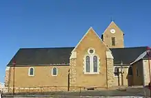
Kirche Saint-Philibert
Literatur
- Le Patrimoine des Communes de la Sarthe. Flohic Editions, Band 1, Paris 2000, ISBN 2-84234-106-6, S. 307–311.
This article is issued from Wikipedia. The text is licensed under Creative Commons - Attribution - Sharealike. The authors of the article are listed here. Additional terms may apply for the media files, click on images to show image meta data.