Pincé
| Pincé | ||
|---|---|---|
.svg.png.webp)
|
| |
| Staat | Frankreich | |
| Region | Pays de la Loire | |
| Département (Nr.) | Sarthe (72) | |
| Arrondissement | La Flèche | |
| Kanton | Sablé-sur-Sarthe | |
| Gemeindeverband | Sablé-sur-Sarthe | |
| Koordinaten | 47° 48′ N, 0° 23′ W | |
| Höhe | 21–53 m | |
| Fläche | 5,79 km² | |
| Einwohner | 191 (1. Januar 2019) | |
| Bevölkerungsdichte | 33 Einw./km² | |
| Postleitzahl | 72300 | |
| INSEE-Code | 72236 | |
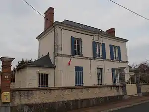 Rathaus (Mairie) von Pincé | ||

Pincé ist eine französische Gemeinde mit 191 Einwohnern (Stand: 1. Januar 2019) im Département Sarthe in der Region Pays de la Loire. Sie gehört zum Arrondissement La Flèche und zum Kanton Sablé-sur-Sarthe. Die Einwohner werden Pincéens genannt.
Geographie
Pincé liegt etwa 49 Kilometer südwestlich von Le Mans an der Sarthe. Umgeben wird Pincé von den Nachbargemeinden Sablé-sur-Sarthe im Norden und Nordosten, Courtillers im Osten und Nordosten, Précigné im Süden sowie Saint-Denis-d’Anjou im Westen.
Bevölkerungsentwicklung
| Jahr | 1962 | 1968 | 1975 | 1982 | 1990 | 1999 | 2006 | 2018 |
| Einwohner | 151 | 117 | 107 | 171 | 192 | 187 | 196 | 192 |
| Quellen: Cassini und INSEE | ||||||||
Sehenswürdigkeiten
- Kirche Saint-Aubin aus dem 11. Jahrhundert, Monument historique
.JPG.webp)
Kirche Saint-Aubin
This article is issued from Wikipedia. The text is licensed under Creative Commons - Attribution - Sharealike. The authors of the article are listed here. Additional terms may apply for the media files, click on images to show image meta data.